Carlops
Villages in the Scottish Borders

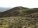
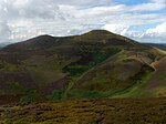
Carlops (Scottish Gaelic: Leum na Caillich) is a small village in the Pentland Hills, within the Scottish Borders area of Scotland, close to the boundary with Midlothian. It lies between West Linton and Penicuik. The village was founded in 1784 and developed cotton weaving, coalmining and limestone mining. The name derives from the Scots "Carlins Lowp" (English: "Witches' Leap"), since near the south of the village there are two exposed rock faces about 20 m (66 ft) high facing each other, with a similar distance between them. Folklore maintained that witches would leap from one face to the other, over the chasm, for entertainment of an evening.
Excerpt from the Wikipedia article Carlops (License: CC BY-SA 3.0, Authors, Images).Carlops
Ramsay Cottages,
Geographical coordinates (GPS) Address Nearby Places Show on map
Geographical coordinates (GPS)
| Latitude | Longitude |
|---|---|
| N 55.79 ° | E -3.34 ° |
Address
Ramsay Cottages
Ramsay Cottages
EH26 9NF
Scotland, United Kingdom
Open on Google Maps


