place

Northampton Medieval Synagogue

Archaeological sites in NorthamptonshireBuildings and structures in NorthamptonEngvarB from September 2018Jews and Judaism in EnglandMedieval synagogues in England
Religion in Northampton

The Northampton Medieval Synagogue is an archaeological site and medieval synagogue building in Sheep Street, Northampton, England. The synagogue was discovered in 2010 by Marcus Roberts of National Anglo-Jewish Heritage Trail (JTrails) after many years of researching Northampton's medieval Jewish history. Records tell that the synagogue appeared to have survived the expulsion of Jews in 1290 and the great fire of Northampton in 1674. Town clerk records from 1751 describe the building as "very substantial; a fair stately hall."The remains of the medieval synagogue include stone walls and a stone staircase located 12 feet underneath a kebab shop, the Kebabish takeaway, and a neighbourhood pub. A wall in the cellar of the pub, named "The Bear," was part of the ancient synagogue.Northampton was among the largest medieval Jewish communities in England. Remnants of a Jewish cemetery have also been discovered by archaeologists.

Excerpt from the Wikipedia article Northampton Medieval Synagogue (License: CC BY-SA 3.0, Authors).

Northampton Medieval Synagogue
Sheep Street,

Geographical coordinates (GPS) Address Nearby Places
placeShow on map

Wikipedia: Northampton Medieval SynagogueContinue reading on Wikipedia

Geographical coordinates (GPS)

Latitude Longitude
N 52.2389354 ° E -0.8979419 °
placeShow on map

Address

Al Fairoz Kebabish

Sheep Street 9
NN1 2LT , Semilong
England, United Kingdom
mapOpen on Google Maps

Share experience

Nearby Places

Northampton Abbey of St James

The Northampton Abbey of St James was founded in Northampton in 1104–05 by William Peverel, as a house of Augustinian canons, and was dedicated to St James. William Peverel endowed it with some forty acres in nearby Duston, the church of Duston, and the parish's mill. The abbey's endowments were quickly increased and within a century the abbey was in possession of ten churches, mostly in Northamptonshire; in addition to these, the abbey also held farms, or received rents from some thirty different parishes in the county.One account concerning the abbey notes, "On the forfeiture of Peverel the manor of Duston was granted by Henry II to Walkelin de Duston, who afterwards adopted the religious habit and entered the abbey of St. James, of which he subsequently became abbot." The abbey church was rebuilt on a large scale during the reign of King Edward I and completed in around 1310. By the time of the dissolution it was reported that the monastery was well kept, the community held in high esteem and with a lot of good done for the poor of the area. Nonetheless, it was dissolved in 1538 and granted to Nicholas Giffard who converted the buildings into a mansion. The abbey was located in the Abbots Way area, off the south side of Weedon Road in the town. The former Express Lift factory including the lift-testing tower, was redeveloped for housing in 1999–2000. The site was known to occupy part of the precinct of the abbey. Excavations were carried out to determine the location and remains of any parts of the abbey. The abbey and a cemetery were located. The main buildings were preserved beneath the new housing development. The cemetery of c.300 burials was excavated during winter 2000–2001. The bones were analysed to determine the health and burial practices in the late medieval population of Northampton.294 burials were uncovered in well ordered rows, with many wooden coffins, graves lined with old ceramic roof-tiles, stone-lined graves and a single stone coffin suggesting the occupants of relatively high status. Use of the cemetery later was less orderly. Burials were in simple, shallow graves with just a shroud. On the south side was a stone-built building with two mortuary chapels. One had a stone-lined tomb, and a fragment of life-sized sculptured leg, with chain mail and a stirrup strap from a broken effigy. This may have happened at the dissolution of the abbey in 1538. A highly decorated grave slab and the remains of two skeletons had been unearthed in 1970.Analysis of the burials shows a large number of elderly people many having suffered from trauma such as leg fractures, fused and/or deformed leg joints and advanced spine degeneration. Many of these may have died in the abbey infirmary and further analysis is being undertaken.Nothing now remains except the tomb slab of Abbott de Flore in the vestry of Duston church.

Northampton War Memorial

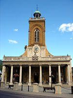
Northampton War Memorial, officially the Town and County War Memorial, is a First World War memorial on Wood Hill in the centre of Northampton, the county town of Northamptonshire, in central England. Designed by architect Sir Edwin Lutyens, it is a Stone of Remembrance flanked by twin obelisks draped with painted stone flags standing in a small garden in what was once part of the churchyard of All Saints' Church. Discussion of a war memorial for Northampton began shortly after the armistice in 1918, and from July 1919 a temporary wooden cenotaph stood on Abington Street in the town centre. The Northamptonshire War Memorial Committee commissioned Lutyens to design a permanent memorial. The monument's design was completed and approved quickly, but its installation was delayed by six years until the site could be purchased from the Church of England, which required a faculty from the local diocese. The memorial was finally unveiled on 11 November 1926 after a service and a parade including local schoolchildren and civic leaders. Northampton's memorial is one of the more elaborate town memorials in England. It uses three features characteristic of Lutyens's war memorials: a pair of obelisks, the Stone of Remembrance (which Lutyens designed for the Imperial War Graves Commission), and painted stone flags on the obelisks, which were rejected for his Cenotaph in London but feature on several of his other memorials. Today it is a Grade I listed building; it was upgraded from Grade II in 2015 when Lutyens's war memorials were declared a "national collection" and all were granted listed building status or had their listing renewed.

Northampton's tunnels

According to some sources several tunnels run underneath the streets of the town of Northampton in England, along with many medieval cellars and ancient crypts. Much of the present town's development took place during medieval times, and some cellars from the period remain. Although some of these chambers are connected and others may have been connected in the past, it is doubtful if they ever have formed an extensive connected network.West Northamptonshire District Council say that to their knowledge there is only one tunnel which runs from All Saints Church across Mercers Row. The Northampton Chronicle and Echo published a plan of this provided by the Council showing the tunnel beginning on the north side of the church in Mercers Row where there was a man hole cover. The tunnel was then shown running eastwards across the mouth of Wood Hill where it turned north across the end of Abington Street into the Market Square on the east side just north of the junction with Abington Street The newspaper further reported that cellars which form part of the tunnel shown on the plan, along with other cellars nearby were used as air raid shelters during World War 2. An employee of the Shipmans Public House said the pub had a cellar with a door in it and there was a tunnel behind the door.Many of the medieval cellars are thought to have originated from the church buildings, that today are centred on All Saints Church – for instance underneath the Northampton & County Club in George Row (opposite the church) some fine vaulted cellars can be seen. There are similar tunnels on the other side of the church at Drum Lane – underneath the Shipman's public house. John Speed's map of Northampton from 1610 shows that the church was then the largest landowner in the town. Clashes took place over the years between the church and the monarchy – such as the banning of markets being held in the churchyards. It is thought that some of these tunnels were established as escape routes for clergy during times of trouble. The various religious houses in early times were found at all the main 8 compass points – giving rise to a series of radial tunnels heading out from All Saints Church at the centre of town to the various houses. Some tunnels had a more mundane function – channelling water from the springs on what is now the Racecourse and Springfield into the town centre. These conduits were known respectively as the Great and the Little Conduits. Northampton Castle was once one of the most important in the country and there is a suggestion that at least one tunnel linked the castle to All Saints Church – and even that such a tunnel might have been utilised by Thomas Becket in his escape from the castle and the town on his way to France. Another theory suggests that the cellars may have been used as a refuge from town fires common in timbered medieval towns such as Northampton – as seen in 1516. It is also thought that a tunnel may have allowed the nuns of Delapré Abbey, on the outskirts of the town to escape the Battle of Northampton (1460) which raged in their grounds. It is thought that this tunnel ran via St John's Church at the bottom of Bridge Street.