place

Altaville, California

1852 establishments in CaliforniaCalaveras County, California geography stubsCalifornia Historical LandmarksPopulated places established in 1852Unincorporated communities in Calaveras County, California
Unincorporated communities in CaliforniaUse mdy dates from July 2023

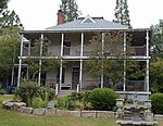
Altaville (Alta, Spanish for "Upper" and Ville, French for "town") is a former unincorporated community in Calaveras County, California, now located in the northwest portion of the city of Angels Camp. It sits at an elevation of 1,542 feet (470 m) above sea level and is located at 38°05′02″N 120°33′43″W, at the intersections of SR 49 and SR 4. The community is in ZIP code 95221 and area code 209. The town was established in 1852 on Cherokee Creek and was known variously as Cherokee Flat, Forks-of-the Road, Low Divide, and Winterton over its history. Notorious bandit Joaquin Murrieta supposedly spent so much time here that a mountain northwest of the creek was named Joaquin Mountain. Although gold was discovered here in 1854, it didn't last long, but the town survived due to its position as an important point for supplies and machinery. D.D. Demerest established a foundry here in 1854, and others soon followed. Most of the stamp mills and a large part of the mining machinery erected in Calaveras and Tuolumne Counties were built at the Altaville Foundry. A brick schoolhouse was built at Altaville in 1858 and the townsite was established in 1873. A post office was established in 1904, closed in 1943, and re-established in 1944.Altaville was also the site of an archaeological hoax, the Calaveras Skull. The town today is registered as California Historical Landmark #288.

Excerpt from the Wikipedia article Altaville, California (License: CC BY-SA 3.0, Authors).

Altaville, California
North Main Street,

Geographical coordinates (GPS) Address Nearby Places
placeShow on map

Wikipedia: Altaville, CaliforniaContinue reading on Wikipedia

Geographical coordinates (GPS)

Latitude Longitude
N 38.083888888889 ° E -120.56194444444 °
placeShow on map

Address

North Main Street 169
95222
California, United States
mapOpen on Google Maps

Share experience

Nearby Places

Prince-Garibaldi Building

Prince-Garibaldi Building is a historical building in Altaville, California in Calaveras County. Altaville, California is just north of the town of Angels Camp. The building was built by B. R. Prince and G. Garibardi in 1852 as a general store on the first floor. The building is built built by David Strosberger out of rhyolite tuff stones designed. In 1857 a second floor was added and used for the store owner's living space. For a time the building was the Prince Undertaking Parlor with a plumed horse hearse. The Prince-Garibaldi Building is a California Historical Landmark No. 735 of California State Route 49.Bartholomew Romaggi Prince, B. R. Prince, Bartolo Prince, was born on March 7, 1829, in Romaggi, Liguria, Italy. He came to California in 1852. He married Mary Ann Hanratty (1839-1890) born in Northern Ireland died in Altaville. Prince and Garabardi opened the goods store in Altaville. Later he opened a quartz mine looking for gold in the California Gold Rush. Prince opened and ran the Altaville Hotel (on Murphys Road), livery stable (Prince's Livery and Feed on Angels Camp Rd. and San Andreas Rd., now the site of Altaville Aquatic Center), the Murphys Toll Road (now Grade Road), and undertaking parlor. For a time he ran a silkworm firm, the silk he sold to Italy. His silk won prizes at the local Calaveras County Fair. Prince owned most of the town's commercial firm for 47 years. When he retired he moved to Stockton, California, he died June 7, 1905, at age 76. Edward R. Prince, Frank R. Prince, Tessie R. [Prince] Favinger, Mary L. Buhrer, Lawrence G. Preston [AKA Goldstone], Bartolo and Mary Prince children and inlaws were: Frank Romaggi Prince (1861–1907), Dante Prince (1864–1911), Mary Romaggi Prince Fischer (1866–1920), Domingo Romaggi Prince (1868–1890), Joseph Romaggi Prince (1873–1923), Theresa Romaggi Prince Favinger (1873–1962) and Edward Romaggi Prince (1875–1945).

Carson Hill, California

Carson Hill (also, Carson Flat and Melones and Slumgullion) is a ghost town in Calaveras County, California. It sits at an elevation of 1447 feet (441 m) above sea level and is located at 38°01′42″N 120°30′24″W, about 4 miles (6.4 km) south-southeast of Angels Camp. It was one of the most productive mining camps in the state, with nearly $26 million in gold and quartz found in the area. Carson Hill is registered as California Historical Landmark #274. The town was served by the Sierra Railway's branchline to Angels Camp until 1935.Unlike most of the places with "Carson" in their names in the American West, Carson Hill is not named after explorer Kit Carson, but instead it is named for Sgt. James H. Carson, a member of Colonel Jonathan D. Stevenson's Regiment of First New York Volunteers. He happened to be in Monterey when the California Gold Rush started. Carson first made his way to Weber Creek near Placerville and then moved south with the Angel and Murphy brothers (founders of Angels Camp and Murphys, respectively). After splitting up at what is now Angels Camp, Carson's group headed south and panned at a small tributary of the Stanislaus River, which they found incredibly rich in gold. They named this portion Carson Creek. Carson himself decided to move on to other locations, but was unsuccessful. He returned to Carson Creek, but never really cashed in on the success. He died in 1853 of rheumatism, near poverty. The Morgan Mine was one of the richest mines in the area, so much so that the miners didn't even have to dig. They would simply blow up a vein and collect the pieces. The mine was also where one of the largest nuggets in the state was discovered, a 195-pound troy block of gold that was worth $43,000 at the time. One of the Gold Country's more colorful stories is reported to have occurred here (although several other camps lay claim to a similar tale) during the early days of the rush. The tale goes that a man who had lost his life in a mining accident was being buried in the local cemetery. As the services were being held, one of the mourners noticed something glittering in the newly turned earth of the open grave. The ceremony was forgotten as everyone, the minister included, quickly located a claim. The town's former name was transferred to another place several miles away, Melones, California. The name Carson Hill was also used by the post office in the nearby town of Irvine.