place

Major Taylor Velodrome

1982 establishments in IndianaCycling venue stubsIndiana building and structure stubsIndiana sport stubsMidwestern United States sports venue stubs
Sports venues completed in 1982Sports venues in IndianapolisVelodromes in the United States
Major Taylor Velodrome (14713226062)

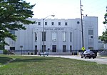
The Major Taylor Velodrome is an outdoor, concrete velodrome in Indianapolis, Indiana, U.S., named for 1899 cycling world champion Major Taylor. The 333.34 m (364.55 yd) track with 28 degree banked turns and 9 degree straights. The Velodrome is located immediately north of the Marian University campus and is the home track of the 41-time USA Cycling National Champion Marian University Cycling Team. The velodrome was opened in July 1982 for the U.S. Olympic Festival. It was built at a cost of $2.5 million. It was a facility required to host that year's National Sports Festival, with money coming from a partnership between the Indianapolis Parks and Recreation Department and the Lilly Endowment. It was the first building built with public money in Indianapolis to be named after an African American. The proposal to name the facility for Taylor came initially from Tom Healy, a writer for the Indianapolis News, who contacted Taylor's daughter, Sidney Taylor Brown. The two advocated among the city's business community and Mayor William H. Hudnut.It has played host to many national and international competitions, including cycling events of the 1987 Pan American Games; USA Cycling's Collegiate Track National Championships in 2003, 2010, 2011, 2014, and 2017; and USA Cycling's Masters Track National Championships in 2005, 2013, and 2016. In May 2011, Marian University took over operations of the velodrome property, known as the Indy Cycloplex, which includes a BMX track, mountain bike trails, cyclocross course, and public green space. In the years following the shift in operation, the facility has focused on promoting youth health and fitness as well as the continuous development of the sport of competitive cycling. Weekly and daily programming takes place on the Velodrome from April through September, including a Thursday night race series, the Major Taylor Racing League.

Excerpt from the Wikipedia article Major Taylor Velodrome (License: CC BY-SA 3.0, Authors, Images).

Major Taylor Velodrome
Indy Cycloplex BMX Track, Indianapolis

Geographical coordinates (GPS) Address External links Nearby Places
placeShow on map

Wikipedia: Major Taylor VelodromeContinue reading on Wikipedia

Geographical coordinates (GPS)

Latitude Longitude
N 39.821444444444 ° E -86.199361111111 °
placeShow on map

Address

Major Taylor Velodrome

Indy Cycloplex BMX Track
46228 Indianapolis
Indiana, United States
mapOpen on Google Maps

linkWikiData (Q6738305)
linkOpenStreetMap (492868415)

Major Taylor Velodrome (14713226062)
Share experience

Nearby Places

Golden Hill Historic District (Indianapolis, Indiana)

Golden Hill is an affluent and historic neighborhood overlooking the White River on the west side of Indianapolis's Center Township, in Marion County, Indiana. The district is bounded on the east by Clifton Street, which is west of Martin Luther King Jr. Boulevard (formerly Northwestern Avenue); on the west by the White River and the Central Canal; on the south by Thirty-sixth Street; and on the north by Woodstock Country Club, immediately south of Thirty-eighth Street. Golden Hill is noted for its collection of homes designed by several of the city's prominent architects. The estate homes reflect several styles of period revival architecture. The district is known as for its community planning and remains an exclusive enclave for the city's prominent families. Golden Hill was added to the National Register of Historic Places in 1991. Originally platted by 1872, the area remained undeveloped until David McLean Parry, a wealthy Indianapolis industrialist, acquired a 100 acres (40 hectares) tract on a ridge overlooking the White River between 1900 and 1907. The neighborhood takes its name from Parry's Golden Hill estate home. Scottish landscape architect George MacDougall designed its grounds. Further development began after Parry's death in 1915, when Parry's heirs hired MacDougall to plan an elegant residential subdivision. Platted as Golden Hill Estates, it was among the city's elite neighborhoods by the 1920s. Fifty-four grand homes, several of them designed by Indianapolis's leading architects, were built along Golden Hill's winding, tree-lined streets. All but eleven of them were built between 1915 and 1940, the historic district's period of significance. The neighborhood's oldest home dates to 1895. One of Golden Hill's unusual features was an Alaskan totem pole that once stood near on the Parry estate. Totem Lane is named in reference to the local landmark, which was one of fifteen totem poles that Alaska's district governor, John Green Brady, collected from villages in southeastern Alaska in 1903. They were displayed at the Louisiana Purchase Exposition in Saint Louis in 1904. (The one that ended up at Golden Hill was placed outside the Esquimau Village.) A replica of the Golden Hill totem pole is installed at The Eiteljorg Museum of American Indians and Western Art in Indianapolis.