place

Llyn Llyffant

CaerhunClwyd geography stubsLakes of Conwy County BoroughLakes of Snowdonia

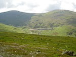
Llyn Llyffant is the highest lake in Wales, located at grid reference SH 687 645. Its name translates into English as "frog lake". It lies at an elevation of approximately 815m above sea level.

Excerpt from the Wikipedia article Llyn Llyffant (License: CC BY-SA 3.0, Authors).

Geographical coordinates (GPS)

Latitude Longitude
N 53.161944444444 ° E -3.9636111111111 °
placeShow on map

Address

Caerhun


Wales, United Kingdom
mapOpen on Google Maps

Share experience

Nearby Places

Foel-fras
Foel-fras

Foel-fras (944 m) is a mountain in the Carneddau range, about 10 km east of Bethesda in Wales. It lies on the border between the counties of Gwynedd and Conwy. With a summit elevation of 944 m it is officially the eleventh-highest summit in Wales. Foel-fras is located at the northern end of the main ridge of the Carneddau, between Drum to the north and Foel Grach to the south, with the subsidiary summit of Garnedd Uchaf (925 m) between it and Foel Grach. Due south and 400 m below lies the reservoir of Llyn Dulyn, while the smaller reservoir of Llyn Anafon lies to the north. Because of its position, it is the first of the Welsh 3000s reached when doing this walk from the northern end. It can be climbed by driving up the small road signposted "Aber Falls" in the village of Abergwyngregyn, passing the car park for the falls and continuing to a small car park at the end of the road. From there it is possible to take the track bearing left, later turning right to the summit of Drum and continuing along the ridge, or to take the track leading straight on to Llyn Anafon and then climbing up to the ridge between Drum and Foel Fras. An alternate route up the mountain is to start at the Western end of the Bwlch-y-Ddeufaen pass and take the steep track up the side of Drosgyl, following the fence line all the way to where the ground levels off. Here the views open up and the fence changes direction, running off at almost a right angle to the Southeast (left). From here, follow a small track Southwest until it intersects the larger track previously mentioned - marked by a small quartz-peppered cairn - which will lead you to Drum. From Drum the walk to the summit of Foel Fras is simply parallel to the fence line, which changes into a dry stone wall as you are nearing the summit. Car parking is available at the Eastern end of the pass.The summit plateau has some ornithological interest in that it is one of the best places in Wales to observe dotterel on their spring and less frequent autumn migration.Foel Fras can also be reached from Llanfairfechan, an equally beautiful route as that from Aber Falls. Follow the road up through the village of Llanfairfechan until Terrace Walk, take the path from Terrace Walk that takes you past Hengae Farm, then follow the path that can take you to the summit of Garreg Fawr, Drum, Foel Fras and more.

Welsh 1000 m Peaks Race

The Welsh 1000m Peaks Race takes place on the first Saturday in June each year. The 32 km route is also known as the Snowdonia Summits Marathon as competitors have to reach the top of all the 1000 metre peaks in Wales. Carnedd Llewelyn 1064m (3491 feet) Carnedd Dafydd 1044m (3425 feet) Glyder Fawr 1001m (3281 feet) Garnedd Ugain 1065m (3493 feet) and Snowdon (Yr Wyddfa) 1085m (3560 feet)Runners also have to pass through several other checkpoints; this gives a total of around 8000 feet of ascent for competitors. In previous years only the lower slopes of the Glyderau would be crossed, however in September 2010, the summit of Glyder Fawr was remeasured at 1001m.The organisers of the race included this summit from 2011. It is a tough endurance event and required navigational skills. The idea was the brainchild of Ron James, the warden of Ogwen Cottage Outdoor Pursuits Centre, along with Dr Ieuan Jones, who invited 60 people to participate in a trial event in 1970. The first race proper was held in 1971 with men starting from the shoreline at Abergwyngregyn, on the shoreline of Conwy Bay, and ladies from the Ogwen Valley. Both finished on the summit of Snowdon after which entrants were still responsible for their own safety and descent to the valley. The early events were for mountaineers, with kit checks to ensure boots were adequate & rucksacks a certain minimum weight, and groups such as West Bromwich Mountaineering Club participated every year. The Army supported the whole event, providing checkpoints throughout the route. Later a Fell running class was introduced and a team event. The Gorphwysfa Club took over the race organisation from the military in the 1990s. The fastest times are 3h 27m 20s recorded by Gavin Bland in 1999 and, for women, 4h 2m 39s by Angela Mudge also in 1999. The record for the team event (the accumulated times of the 3 best finishers) is 13h 41m 56s set in 1996 by the Reserves team of the Royal Regiment of Wales. The event is currently sponsored by the First Hydro Company.