Schurwald
Forests and woodlands of Baden-WürttembergHill ranges of GermanyNatural regions of the Swabian Keuper-Lias PlainsRegions of Baden-Württemberg

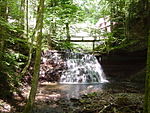
The Schurwald is a wooded mountain range in Baden-Württemberg, southern Germany, which at its highest point is 513.2 m above sea level. It is one of the most important Recreation areas for the Stuttgart area. Over the centuries, the vast forests of the mountain range supplied the surrounding towns and villages with wood for fuel and building material, and thus acquired the name "Schurwald", which comes from the German word, Schur, which can mean a shearing or clearcutting.
Excerpt from the Wikipedia article Schurwald (License: CC BY-SA 3.0, Authors, Images).Schurwald
Ilgenäcker, Vereinbarte Verwaltungsgemeinschaft der Stadt Schorndorf
Geographical coordinates (GPS) Address Nearby Places Show on map
Geographical coordinates (GPS)
| Latitude | Longitude |
|---|---|
| N 48.766666666667 ° | E 9.5 ° |
Address
Ilgenäcker
Ilgenäcker
73614 Vereinbarte Verwaltungsgemeinschaft der Stadt Schorndorf (Schlichten)
Baden-Württemberg, Germany
Open on Google Maps


