Kösseine

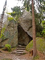
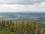
The Kösseine is a massif in the High Fichtel mountains in Germany, lying in northeast Bavaria south of Wunsiedel. The highest elevation of this granite massif is the summit of the Große Kösseine, 939 m above sea level (NN). The border between the Bavarian provinces of Upper Franconia and Upper Palatinate runs over the Kösseine as does the European watershed between the North Sea and the Black Sea. Around the Kösseine are the settlements of Wunsiedel, Marktredwitz, Bad Alexandersbad, Waldershof, Hohenhard, Neusorg, Brand, Ebnath, Nagel and Tröstau, tourist resorts within the Fichtel Mountains. On the Kösseine rises an eponymous stream (officially called the Kössein), which flows through Waldershof and Marktredwitz before discharging into the Rösla, a tributary of the Ohře, near Seußen.
Excerpt from the Wikipedia article Kösseine (License: CC BY-SA 3.0, Authors, Images).Kösseine
kleine Kösseine Trail, Tröstauer Forst-Ost
Geographical coordinates (GPS) Address Nearby Places Show on map
Geographical coordinates (GPS)
| Latitude | Longitude |
|---|---|
| N 49.98861 ° | E 11.98028 ° |
Address
Gipfel der Großen Kösseine
kleine Kösseine Trail
95632 Tröstauer Forst-Ost
Bavaria, Germany
Open on Google Maps


