Charron Island
Hochelaga ArchipelagoIslands of the Saint Lawrence RiverLandforms of MontérégieLongueuilRiver islands of Quebec ... and 1 more
Use Canadian English from January 2023

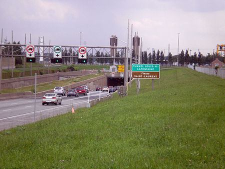
Charron Island (French: Île Charron) is an island in the Saint Lawrence River, the westernmost of the Îles de Boucherville archipelago, near Îles-de-Boucherville National Park to the northeast of Montreal. It is part of the city of Longueuil, and is connected to the mainland and the Island of Montreal by the Louis-Hippolyte Lafontaine Bridge–Tunnel which carries Quebec Autoroute 25 and the Trans-Canada Highway.
Excerpt from the Wikipedia article Charron Island (License: CC BY-SA 3.0, Authors, Images).Charron Island
Sentier de l'île-Charron,
Geographical coordinates (GPS) Address Nearby Places Show on map
Geographical coordinates (GPS)
| Latitude | Longitude |
|---|---|
| N 45.585212 ° | E -73.482335 ° |
Address
Sentier de l'île-Charron
Sentier de l'île-Charron
J4G 1R6
Quebec, Canada
Open on Google Maps


