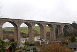
Gwinear, Cornwall
Former civil parishes in CornwallMining in CornwallVillages in Cornwall

Gwinear (Cornish: Gwynnyer) is a small village in west Cornwall, England, UK. It is about two miles (3 km) east of Hayle and overlooks the Angarrack valley. It is in the civil parish of Gwinear-Gwithian. Gwinear village sits on a hill with expansive views from the northern end of the village down the Angarrack valley. There is a local pub, the Royal Standard, and a community hall. Gwinear is the church town of Gwinear-Gwithian civil parish.
Excerpt from the Wikipedia article Gwinear, Cornwall (License: CC BY-SA 3.0, Authors, Images).Gwinear, Cornwall
Herland Hill,
Geographical coordinates (GPS) Address Nearby Places Show on map
Geographical coordinates (GPS)
| Latitude | Longitude |
|---|---|
| N 50.18796 ° | E -5.37115 ° |
Address
Herland Hill
Herland Hill
TR27 5JY , Gwinear-Gwithian
England, United Kingdom
Open on Google Maps


