place

Mount Baker–Snoqualmie National Forest

1974 establishments in Washington (state)Mount Baker-Snoqualmie National ForestNational Forests of Washington (state)North Cascades of Washington (state)Protected areas established in 1974
Protected areas of King County, WashingtonProtected areas of Kittitas County, WashingtonProtected areas of Pierce County, WashingtonProtected areas of Skagit County, WashingtonProtected areas of Snohomish County, WashingtonProtected areas of Whatcom County, Washington
N2 Glacier Peak
N2 Glacier Peak

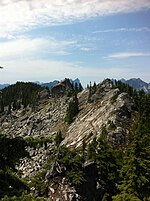
The Mount Baker–Snoqualmie National Forest in Washington is a National Forest extending more than 140 miles (230 km) along the western slopes of the Cascade Range from the Canada–US border to the northern boundary of Mount Rainier National Park. Administered by the United States Forest Service, the forest is headquartered in Everett. There are local ranger district offices in North Bend and Skykomish.

Excerpt from the Wikipedia article Mount Baker–Snoqualmie National Forest (License: CC BY-SA 3.0, Authors, Images).

Mount Baker–Snoqualmie National Forest
Ludwigsburger Straße, Gemeindeverwaltungsverband Steinheim-Murr

Geographical coordinates (GPS) Address Nearby Places
placeShow on map

Wikipedia: Mount Baker–Snoqualmie National ForestContinue reading on Wikipedia

Geographical coordinates (GPS)

Latitude Longitude
N 47.766 ° E -121.378 °
placeShow on map

Address

Ludwigsburger Straße 2
71711 Gemeindeverwaltungsverband Steinheim-Murr
Baden-Württemberg, Deutschland
mapOpen on Google Maps

N2 Glacier Peak
N2 Glacier Peak
Share experience

Nearby Places

Baring Mountain
Baring Mountain

Baring Mountain (or Mount Baring), is a peak in the central part of the Cascade Range of Washington, United States. It lies about 2 miles (3.2 km) northeast of the Skykomish River and US Highway 2, at the western edge of the Cascades in the Mount Baker-Snoqualmie National Forest. It is about 6 miles (9.7 km) east of Mount Index and Barclay Lake at its base is accessible via Forest Road 6024 and a 2.2-mile (3.5 km) hike.Baring Mountain was previously known as Mount Index before being renamed in 1917. The peak currently named Mount Index was known as West Index Mountain until that time.Like Mount Index, Baring Mountain is a dramatic peak, because of its steep rise above low footings, the Skykomish River is at an elevation of only 760 feet (230 m), and particularly because of its large, sheer Northeast Face, which drops about 750 m (2,460 ft) in only 250 m (820 ft) and drops another 1,250 ft (380 m) at a lower angle to Barclay Lake. The first recorded ascent of Baring Mountain was on July 28, 1897, by John Charlton and Albert H. Sylvester. However given the nontechnical nature of the easiest ascent route a much earlier Native American ascent is possible. The standard route on the mountain is the Northwest Ridge Route, involving hiking (off-trail, some of it through brush) and a small amount of scrambling at the top. The northeast aspect of the peak is home to several routes of great length and technical difficulty (up to Grade VI, 5.12b). The northeast face was first climbed on July 13, 1960, by Ed Cooper and Don Gordon Claunch.The first BASE jump off Baring Mountain was done by Todd Higley and Josh Whipple, in August 2001. Michael McMurtrey, of Seattle, was the first to jump from Baring using a wingsuit, in June 2004.

Skykomish station
Skykomish station

The Great Northern Depot in Skykomish, Washington, United States, is a former train station and local history museum. It was built by the Great Northern Railway in 1894 to serve the town of Skykomish, which had been founded as a division point on the railroad. Its original location was on the south side of the tracks at 5th Street. In 1922, the depot was moved to its present location on the north side of the tracks at 4th Street.The depot is a one-story rectangular wood-frame building. It consisted of a passenger waiting room, the station agent's office and a freight room. The adjacent railyard was used by helper locomotives on the grade up to Stevens Pass.Passenger service to Skykomish ended in the 1950s, coinciding with the dismantling of Great Northern's electrified system through the town. In 1970, the Great Northern was merged into the Burlington Northern Railroad. The yard and buildings at Skykomish ceased to be used.The depot was listed in the National Register of Historic Places in 1997 as one of the last Great Northern depots still remaining in Washington state and for its association with railroad development in the state.The railyard adjacent to the depot had been seeping oil and heavy metals into the ground and nearby Skykomish River for most of the 20th century, requiring extensive environmental remediation. Following the discovery of contaminated soil and groundwater in the 1980s, Burlington Northern and its successor, BNSF Railway, agreed to fund several mitigation and cleanup projects under the supervision of the Washington State Department of Ecology. Most of the buildings in downtown Skykomish, including the depot, were temporarily moved for the cleanup project in the 2000s.The Great Northern depot was moved to a new city park in 2012 and was renovated for use as a visitors center and history museum, opened in 2016 by the Skykomish Historical Society. The area around the depot were converted into a ridable miniature railway that operates seasonally on a 7+1⁄2 in (190.5 mm) gauge with steam locomotives.

Beckler River
Beckler River

The Beckler River is a tributary of the South Fork Skykomish River in the U.S. state of Washington in the United States. The Beckler River originates near Jack Pass and flows southeast about 5 miles (8.0 km) where it is joined by the Rapid River, its principal tributary. The Beckler then flows generally south for about 8 miles (13 km) to empty into the South Fork Skykomish River. The upper portion of the Beckler River flows through a narrow, steep, and densely forested valley with slopes rising 4,000 feet (1,200 m) and higher over the valley floor. Over its lower course the river valley widens slightly. In its last half-mile the valley opens out into the South Fork Skykomish valley. The only community in the region is Skykomish.Nearly all the Beckler River's tributaries, with the notable exception of Rapid River, exhibit steep mountain character with numerous cascades and rapids in narrow channels, boulders, and rocky bottoms. The Rapid River is similar in its upper portion, but moderates in its final 3 to 4 miles (4.8 to 6.4 km). Much of the Rapid River's drainage basin has been logged.Much of the Beckler River's drainage basin is within the Wild Sky Wilderness, although the main river itself is not. The Rapid River's basin is within the Wild Sky Wilderness and the Henry M. Jackson Wilderness. Parts of the main Rapid River itself are in both wildernesses. Both wildernesses are part of Mount Baker-Snoqualmie National Forest. Forest Service Road 65, the Beckler River Road, runs north from U.S. Route 2 following the river to Jack Pass and connecting to Forest Service Road 63, the North Fork Skykomish Road.