Edithvale-Seaford Wetlands

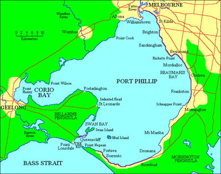
The Edithvale-Seaford Wetlands is a collection of principally freshwater swamps and marshlands totalling 261 hectares (640 acres) in southeastern Melbourne, Victoria, Australia, about 30 km (19 mi) southeast of Melbourne CBD. It is the largest natural wetland of its type in the Port Phillip and Western Port basins, and is all that remains of the historic Carrum Carrum Swamp, which once covered more than 4,000 hectares (9,900 acres) from present-day Mordialloc in the north to Frankston in the south.The surviving wetlands are divided into two groups, namely the northern Edithvale Wetlands (103 hectares or 250 acres in total) and the southern Seaford Wetlands (158 hectares or 390 acres in total), which together form the Edithvale-Seaford Wetlands Ramsar Site. Along with the nearby Eastern Treatment Plant, they form the Carrum Wetlands Important Bird Area.All the wetlands are no more than 2 km (1.2 mi) away from the shore of Beaumaris Bay, bounded by Governor Road in the north, the coastal Nepean Highway in the west, the Mornington Peninsula Freeway and Frankston Freeway in the east, and Seaford Road in the south. Nowadays they are largely surrounded by residential areas, and some parts of the wetlands have been converted to parks, recreational reserves and golf courses.
Excerpt from the Wikipedia article Edithvale-Seaford Wetlands (License: CC BY-SA 3.0, Authors, Images).Edithvale-Seaford Wetlands
Monica Avenue, Melbourne Bonbeach
Geographical coordinates (GPS) Address Nearby Places Show on map
Geographical coordinates (GPS)
| Latitude | Longitude |
|---|---|
| N -38.066666666667 ° | E 145.11666666667 ° |
Address
Monica Avenue
Monica Avenue
3197 Melbourne, Bonbeach
Victoria, Australia
Open on Google Maps


