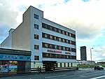
Dennistoun

Dennistoun is a mostly residential district in Glasgow, Scotland, located north of the River Clyde and in the city's east end, about 1+1⁄4 miles (2 kilometres) east of the city centre. Since 2017 it has formed the core of a Dennistoun ward under Glasgow City Council, having previously been a component of the East Centre ward. Aside from the smaller Haghill neighbourhood further east, Dennistoun's built environment does not adjoin any others directly, with the M8 motorway dividing it from Royston to the north, while the buildings of Glasgow Royal Infirmary and Wellpark Brewery plus the Glasgow Necropolis cemetery lie to the west, and railway lines form the southern boundary with the Calton/Gallowgate neighbourhoods, and Camlachie (a historic district which is now largely a retail park) on the opposite side.
Excerpt from the Wikipedia article Dennistoun (License: CC BY-SA 3.0, Authors, Images).Dennistoun
Ingleby Drive, Glasgow Dennistoun
Geographical coordinates (GPS) Address Nearby Places Show on map
Geographical coordinates (GPS)
| Latitude | Longitude |
|---|---|
| N 55.8609 ° | E -4.2161 ° |
Address
Ingleby Drive
Ingleby Drive
G31 2PT Glasgow, Dennistoun
Scotland, United Kingdom
Open on Google Maps


