place

Colne Valley Urban District

Districts of England abolished by the Local Government Act 1972Local government in West YorkshireUrban districts of the West Riding of YorkshireUse British English from February 2023
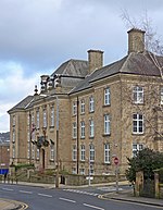
Town Hall, Lewisham Road, Slaithwaite geograph.org.uk 880404

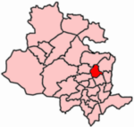
Colne Valley was an urban district in the West Riding of Yorkshire, England between 1937 and 1974. It takes its name from the River Colne which rises above the town of Marsden and flows eastward towards Huddersfield. Colne Valley Urban District was formed on 1 April 1937 following the abolition of many of the urban districts and reallocation of land surrounding Huddersfield and comprised the following former urban district areas: 584 hectares (1,440 acres) of Golcar Urban District — population 7,875 404 hectares (1,000 acres) of Linthwaite Urban District — population 5,220 Marsden Urban District — 3,493 hectares (8,630 acres), population 5,723 Scammonden Urban District — 731 hectares (1,810 acres), population 394 Slaithwaite Urban District — 1,284 hectares (3,170 acres), population 5,183Colne Valley UD was abolished under the Local Government Act 1972, becoming part of the Metropolitan Borough of Kirklees on 1 April 1974. No successor parish was created for the area, but its boundaries remain reflected in a ward of the same name on Kirklees Council.

Excerpt from the Wikipedia article Colne Valley Urban District (License: CC BY-SA 3.0, Authors, Images).

Colne Valley Urban District
Straits, Bradford Baildon

Geographical coordinates (GPS) Address Nearby Places
placeShow on map

Wikipedia: Colne Valley Urban DistrictContinue reading on Wikipedia

Geographical coordinates (GPS)

Latitude Longitude
N 53.854 ° E -1.767 °
placeShow on map

Address

Straits

Straits
BD17 6JT Bradford, Baildon
England, United Kingdom
mapOpen on Google Maps

Town Hall, Lewisham Road, Slaithwaite geograph.org.uk 880404
Share experience

Nearby Places

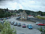
Shipley and Windhill railway station

Shipley and Windhill railway station was a railway station in Shipley, West Yorkshire, England between 1875 and 1931. During the 1860s, two small railway companies were formed to promote suburban railways in Bradford, the Bradford, Eccleshill and Idle Railway and the Idle and Shipley Railway. Their schemes and the companies themselves were taken up by the Great Northern Railway, which built a line looping through the villages to the north-east of Bradford: from Laisterdyke, through Eccleshill, Idle and Thackley to Shipley. The line was open to goods traffic on 4 May 1874 and to passengers on 18 January 1875.The terminus of the new line was called Shipley and Windhill Station (According to Dewick, it was first Shipley (Great Northern) and then Shipley Bridge Street) or possibly Shipley East. The station was on the north side of Leeds Road, west of the Bradford Canal, and less than 330 yards (300 m) from the existing Shipley Station on the Midland Railway. It was built to the same distinctive pattern as other stations on the line, with a short mitre-roofed tower in the centre. Passenger service on the line ceased on 2 February 1931, and the passenger station closed, but goods traffic continued on the whole line until October 1964 and as far as Idle until 1968. The railway line is featured in Simon Ormondroyd's Windhill Tales, based on life in the area in 1964.The station building survives: in 2005 it is occupied by several local businesses. However, proposals put forward in 2016 are for the building to be demolished to make way for apartments. The site has not been given any heritage designation.