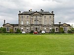
Kirkliston
Parishes formerly in MidlothianParliament of ScotlandScottish parliamentary locations and buildingsTowns in Edinburgh council areaUse British English from January 2017

Kirkliston is a small town and parish to the west of Edinburgh, Scotland, historically within the county of West Lothian but now within the City of Edinburgh council limits. It lies on high ground immediately north of a northward loop of the Almond, on the old road between Edinburgh and Linlithgow (the B9080, now cut off by Edinburgh Airport), having a crossroads with the road from Newbridge to Queensferry and beyond to Fife (the B800). The B800 is variously named Path Brae, High Street, Station Road, and Queensferry Road as it passes through the town. The B9080 is named Main Street and Stirling Road as it passes through.
Excerpt from the Wikipedia article Kirkliston (License: CC BY-SA 3.0, Authors, Images).Kirkliston
Main Street,
Geographical coordinates (GPS) Address Nearby Places Show on map
Geographical coordinates (GPS)
| Latitude | Longitude |
|---|---|
| N 55.956 ° | E -3.403 ° |
Address
Kirkliston Community Church
Main Street 70
EH29 9AB
Scotland, United Kingdom
Open on Google Maps


