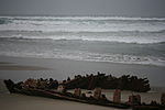
Santa Ynez River

The Santa Ynez River is one of the largest rivers on the Central Coast of California. It is 92 miles (148 km) long, flowing from east to west through the Santa Ynez Valley, reaching the Pacific Ocean at Surf, near Vandenberg Space Force Base and the city of Lompoc. The river drains the north slope of the Santa Ynez Mountains, the south slope of the San Rafael Mountains, as well as much of the southern half of Santa Barbara County. Its drainage basin is 896 square miles (2,320 km2) in area. The river's flow is highly variable. It usually dries up almost completely in the summer, but can become a raging torrent in the winter. The river has three dams which can impound a total of 210,000 acre-feet (260,000,000 m3) of water in wet years.
Excerpt from the Wikipedia article Santa Ynez River (License: CC BY-SA 3.0, Authors, Images).Santa Ynez River
Ocean Park Road,
Geographical coordinates (GPS) Address Nearby Places Show on map
Geographical coordinates (GPS)
| Latitude | Longitude |
|---|---|
| N 34.691944444444 ° | E -120.60194444444 ° |
Address
Ocean Park Road
93437
California, United States
Open on Google Maps


