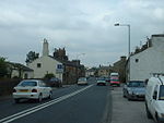
Ellel, Lancashire
Civil parishes in LancashireGeography of the City of LancasterLancashire geography stubsUse British English from April 2015Villages in Lancashire

Ellel is a village and civil parish in the City of Lancaster in the English county of Lancashire. It had a population of 4,895 in 2011, up from 2,521 in 2001 The parish includes the villages of Bay Horse, Galgate and Hampson Green, and part of Dolphinholme. The disused Church of St Mary was built on Ellel Grange estate in 1873 by W. & G. Audsley. The Anglican parish of Ellel is currently served by St John's Church which has stood in its present form since 1907. Hay Carr on the outskirts of Ellel is a country house built by Thomas Lamb in 1750 and later owned by the Sandeman Port family.
Excerpt from the Wikipedia article Ellel, Lancashire (License: CC BY-SA 3.0, Authors, Images).Ellel, Lancashire
Chapel Lane, Lancaster
Geographical coordinates (GPS) Address Nearby Places Show on map
Geographical coordinates (GPS)
| Latitude | Longitude |
|---|---|
| N 53.998 ° | E -2.785 ° |
Address
Chapel Lane 5,6
LA2 0PP Lancaster
England, United Kingdom
Open on Google Maps


