Ferenciek tere
Pest County geography stubsSquares in Budapest
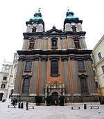
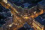
Ferenciek tere (English: Square of the Franciscans) is a square and junction in Budapest. In addition to being the site of a station on the M3 (North-South) line of the Budapest Metro, it is an important public transport junction for the BKV bus line number 7, which connects Pest and southern Buda. The place is right in the middle of the city. The fashionable shopping avenue Váci utca opens from there. The square hosts an internationally recognized gourmet restaurant and a bookstore-publisher complex for Roman Catholic religious literature. The Erzsébet Bridge over the Danube is a five-minute walk from the Metro.
Excerpt from the Wikipedia article Ferenciek tere (License: CC BY-SA 3.0, Authors).Ferenciek tere
Ferenciek tere, Budapest Pest
Geographical coordinates (GPS) Address Website Nearby Places Show on map
Geographical coordinates (GPS)
| Latitude | Longitude |
|---|---|
| N 47.493069444444 ° | E 19.055986111111 ° |
Address
Belvárosi Ferences templom (Alkantarai Szent Péter templom)
Ferenciek tere 9
1053 Budapest, Pest
Hungary
Open on Google Maps


