Graiseley
Areas of WolverhamptonUse British English from May 2017Wards of Wolverhampton City CouncilWest Midlands (county) geography stubs
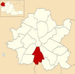
Graiseley is both an inner-city area of Wolverhampton, situated immediately to the south-west of the city centre, and the name of a ward of Wolverhampton City Council.
Excerpt from the Wikipedia article Graiseley (License: CC BY-SA 3.0, Authors).Graiseley
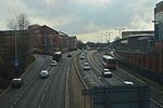
Penn Road, Wolverhampton
Geographical coordinates (GPS) Address Nearby Places Show on map
Geographical coordinates (GPS)
| Latitude | Longitude |
|---|---|
| N 52.5771 ° | E -2.135 ° |
Address
Penn Road
Penn Road
WV3 0DR Wolverhampton
England, United Kingdom
Open on Google Maps


