place

Holywell branch line

1912 establishments in WalesClosed railway lines in WalesGeographic coordinate listsLists of coordinatesRailway lines opened in 1912
Standard gauge railways in WalesTransport in Flintshire

The Holywell branch line was a railway branch line in North Wales that connected Holywell with the North Wales Coast Line at Holywell Junction. Holywell had quite a large amount of mineral resources and the branch line was built originally as a mineral railway. When the local industry declined, the line fell into disuse, but it was reopened as a tourist passenger line in 1912. Road competition made the railway non-viable and this then caused the line to be closed in 1954.

Excerpt from the Wikipedia article Holywell branch line (License: CC BY-SA 3.0, Authors).

Holywell branch line
Greenfield Road,

Geographical coordinates (GPS) Address Nearby Places
placeShow on map

Wikipedia: Holywell branch lineContinue reading on Wikipedia

Geographical coordinates (GPS)

Latitude Longitude
N 53.2824 ° E -3.2153 °
placeShow on map

Address

Greenfield Mills Car Park

Greenfield Road
CH8 7PZ , Holywell
Wales, United Kingdom
mapOpen on Google Maps

Share experience

Nearby Places

North Wales Pilgrim's Way

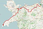
The North Wales Pilgrim's Way (Welsh: Taith Pererin Gogledd Cymru) is a long-distance walking route in North Wales, running from near Holywell in the east to Bardsey Island (Welsh: Ynys Enlli) in the west. The first half of the trail takes an inland route, with the second half (from Abergwyngregyn onwards) following the north coast of the Llŷn Peninsula. It measures 133.9 miles (215 km) in length, and was officially launched at Porth y Swnt, Aberdaron on 10 July 2014.Development of the trail started in 2011, and its official opening followed a number of alterations to the original route to suit local concerns.The route, which is marked by waymarker disks, makes use of existing public rights of way, including sections of the Wales Coast Path, and along the way it visits many small stone churches, many dedicated to key Celtic Saints, which can provide shelter and rest along the trail. Whilst, historically, pilgrims would have made their way across North Wales to Bardsey Island, known as the legendary 'Island of 20,000 Saints', the trail is a modern interpretation, and does not necessarily follow old routes.The Trail is a part of the 'Our Heritage' project, a part of Cadw’s Heritage Tourism Project; this is partially funded by the European Regional Development Fund via the Welsh Government.Dr. Rowan Williams, a Welsh Anglican bishop, theologian and poet, and former archbishop of Canterbury, is patron of the route.An annual pilgrimage is organised along the full length of the route for a fortnight every May/June, and in 2018 the North Wales Pilgrim's Way Ultra - a 3-day race - saw runners competing for the North Wales Pilgrims Way Brass Shield.

St Winefride's Well
St Winefride's Well

St Winefride's Well (Welsh: Ffynnon Wenffrewi) is a holy well and national shrine located in the Welsh town of Holywell in Flintshire. The patron saint of the well, St Winefride, was a 7th-century Catholic martyr who according to legend was decapitated by a lustful prince and then miraculously restored to life. The well is said to have sprung up at the spot where her head hit the ground. This story is first recorded in the 12th century, and since then St Winefride's Well has been a popular pilgrimage destination, known for its healing waters. The well is unique among Britain's sacred sites in that it retained a continuous pilgrimage tradition throughout the English Reformation. During the Middle Ages, the well formed part of the estate of nearby Basingwerk Abbey. It was visited by several English monarchs, including Richard II and Henry IV. Following the establishment of the Church of England, attempts were made by the Protestant authorities to prevent Catholic pilgrimage to the well, but these attempts were unsuccessful. From the 18th century onwards, the well increasingly attracted secular tourism, and it was commonly believed that the well-water had natural healing properties by virtue of its mineral content. Two bath-houses were built on the site in 1869. In 1917, the well dried up as a result of mining operations in the Greenfield valley; to get it flowing again, water had to be diverted from a new underground source. The chapel above the well was built in the 16th century. It is a grade I listed building and a scheduled ancient monument. It comprises two parts, the upper chapel and the well crypt. The upper chapel has seen a variety of uses, including service as a sessions house and a secular day school, but is presently used for religious worship. The well crypt contains a star-shaped basin that encloses the well-spring, and an 18th-century statue of St Winefride. Both sections of the chapel are under state guardianship and managed by Cadw. The well complex is currently open to visitors, who may bathe in the water at certain times of day or fill water bottles from an outdoor tap. There is a visitors' centre and museum on the site. Organised group pilgrimages take place several times a year, and during the pilgrimage season, St Winefride's relic is venerated daily in the well crypt.