place

Hatfield (CDP), Massachusetts

Census-designated places in Hampshire County, MassachusettsCensus-designated places in MassachusettsSpringfield metropolitan area, MassachusettsUse mdy dates from July 2023
Hampshire County Massachusetts incorporated and unincorporated areas Hatfield (CDP) highlighted

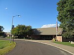
Hatfield is a census-designated place (CDP) comprising the main village in the town of Hatfield in Hampshire County, Massachusetts, United States. The population of the CDP was 1,318 at the 2010 census, out of a total town population of 3,279. It is part of the Springfield, Massachusetts Metropolitan Statistical Area.

Excerpt from the Wikipedia article Hatfield (CDP), Massachusetts (License: CC BY-SA 3.0, Authors, Images).

Hatfield (CDP), Massachusetts
Prospect Street,

Geographical coordinates (GPS) Address Nearby Places
placeShow on map

Wikipedia: Hatfield (CDP), MassachusettsContinue reading on Wikipedia

Geographical coordinates (GPS)

Latitude Longitude
N 42.369722222222 ° E -72.605555555556 °
placeShow on map

Address

Prospect Street 24
01038
Massachusetts, United States
mapOpen on Google Maps

Hampshire County Massachusetts incorporated and unincorporated areas Hatfield (CDP) highlighted
Share experience

Nearby Places

Old Mill Site Historic District

The Old Mill Site Historic District in Hatfield, Massachusetts encompasses the site of a late 19th century mill. It is one of only two such sites in the town. The centerpiece of the district is the former Shattuck Gun Factory building (built 1881), which in 1989 housed newspaper offices and in 2006 a bed and breakfast. The district, which was listed on the National Register of Historic Places in 1982, includes three other elements: an 1891 Warren pony truss bridge across the Mill River, now closed to traffic, and a machine shop and garage (located across the river from the mill), both built in 1886. The district was also included in the larger Mill-Prospect Street Historic District in 2002.The mill site has a history of industrial use since 1661, when Thomas Meekins was granted water rights on the falls, and established a grist mill. He eventually also built a sawmill. Additional mills were built in the early 19th century, including a sawmill which spanned the river. This site was one of Hatfield's major industrial employers in the 19th century. In 1865, the complex was adapted for the production of guns, first by Henry Porter and later by Charles Shattuck. Most of the existing buildings were destroyed in a fire, and Shattuck built the existing mill building in 1881.The main mill building is a three-story wood-frame structure, with a gabled roof and clapboarded exterior. It is seventeen bays long and six wide, and is capped by a cupola with a pagoda-shaped roof. Its foundation is set partly in the river, with its water power provided through a penstock to a turbine chamber in the basement.

Elm Street Historic District (Hatfield, Massachusetts)

The Elm Street Historic District is a rural historic district in southern Hatfield, Massachusetts. It encompasses a landscape that has seen agricultural use since 17th century colonial days, including fields now used for tobacco farming, and historic properties located along five roads: Elm Street, Scotland Road, Sunset Road, Brook Hollow Road, and Little Neponset Road. The district is bounded on its south by the Connecticut River, on its east and north by the Mill River, with a small portion of land border in the northeast which cuts off a large meander in the river. This section, near the junction of Elm and Prospect Streets, is also where this district abuts the Mill-Prospect Street Historic District, which runs north along Prospect Street, and its eastern boundary abuts the Hatfield Center Historic District. Its western boundary is roughly a north-south line in the area of the junction of Elm and Dwight Streets.Most of the buildings in the district are either residential or agricultural in nature, and the district includes the agricultural fields lying south of Elm Street, as well as important agricultural buildings such as tobacco drying barns. The houses in the district stylistically represent the long history of the period, and most home construction in the area had ended by the 1940s. The district was listed on the National Register of Historic Places in 2000.Hatfield was settled in the mid-17th century, and was incorporated as a town in 1670. The Elm Street area was originally common agricultural land, with land along Elm Street formally platted for residential development in 1683. Growth was generally slow, with a significant uptick in new construction after American independence in the late 19th century. Unlike the more prosperous town center, the Elm Street area saw the construction of utilitarian agricultural worker housing. It also saw the growth of some small cottage industries, such as broom-making which were also found in other parts of the town. Tobacco was a major and highly successful crop in the area, resulting in the construction of many tobacco barns. A trolley line built in 1900 on Elm Street to Northampton spurred additional development in the early 20th century.

Upper Main Street Historic District (Hatfield, Massachusetts)

The Upper Main Street Historic District is a predominantly residential historic district in northeastern Hatfield, Massachusetts. Unlike Hatfield Center, which dated to colonial days and lies south of the district, this part of Hatfield developed roughly between 1860 and 1939 as a village centered on the nearby ferry landing on the Connecticut River. The district includes properties in a roughly triangular area bounded by Main Street, King Street, and North Street, and features a large number of Colonial Revival, Queen Anne, and bungalow-style houses. The district was listed on the National Register of Historic Places in 1994.The town center of Hatfield was laid out in 1661, with narrow house lots facing the main road, and large agricultural areas surrounding the village. The southern portion of this district includes a portion of the original town plan, which is still evident in the placement of houses and surrounding land use. In addition to the residential buildings lining its roads, the district also includes agricultural buildings related to the area's historic patterns of agriculture. Prominent among these are several tobacco barns, reflecting the importance of that crop in the town's 19th century economic prosperity. There are also several surviving livestock and horse barns, of which one of the former dates to about 1800. The oldest house in the district, the Jeremiah Bardwell House at 108 Main Street, is of similar vintage, dating to about 1790.