place

Portinscale

AllerdaleEngvarB from July 2016Villages in Cumbria
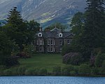
Portinscale geograph.org.uk 1110924

Portinscale is a village in Cumbria, England, close to the western shore of Derwentwater in the Lake District National Park 1+1⁄2 miles (2.5 kilometres) from Keswick. Portinscale is in the civil parish of Above Derwent, the district of Allerdale, the county of Cumbria, the Copeland parliamentary constituency. Prior to Brexit in 2020 it was part of the North West England constituency of the European Parliament. The village covers approximately 100 acres (40 hectares). At the 2011 census the population was 560.The name of the village means "the harlot's hut", deriving from the Old English "portcwene" (harlot) and Old Norse "skáli" (hut). The scholar Eilert Ekwall cites an undated early spelling of the name as "Portquenscale".

Excerpt from the Wikipedia article Portinscale (License: CC BY-SA 3.0, Authors, Images).

Geographical coordinates (GPS)

Latitude Longitude
N 54.603022 ° E -3.163204 °
placeShow on map

Address

Farmers Arms

A594
CA12 5RW , Above Derwent
England, United Kingdom
mapOpen on Google Maps

Phone number

call+441768772322

Website
farmersarmspub.co.uk

linkVisit website

Portinscale geograph.org.uk 1110924
Share experience

Nearby Places

Derwentwater
Derwentwater

Derwentwater, or Derwent Water, is a lake in the Lake District in North West England, immediately south of Keswick. It is in the unitary authority of Cumberland within the ceremonial county of Cumbria. It is the third largest lake by area, after Windermere and Ullswater. It has a length of 4.6 kilometres (2.9 mi), a maximum width of 1.91 kilometres (1.19 mi), and an area of 5.4 square kilometres (2.1 sq mi). Its primary inflow and outflow is the River Derwent, which also flows through Bassenthwaite Lake before reaching the Irish Sea at Workington. There are several islands within the lake, one of which is inhabited. Derwentwater is a place of considerable scenic value. It is surrounded by hills (known locally as fells), and many of the slopes facing Derwentwater are extensively wooded. A regular passenger launch operates on the lake, taking passengers between various landing stages. There are seven lakeside marinas, the most popular stops being Keswick, Portinscale and the Lodore Falls, from which boats may be hired. Recreational walking is a major tourist activity in the area and there is an extensive network of footpaths in the hills and woods surrounding the lake. The Keswick to Borrowdale road runs along the eastern shore of the lake and carries a regular bus service. There is a lesser, or unclassified, road along the western shore connecting the villages of Grange and Portinscale. Derwentwater gave its name to the Earldom of Derwentwater. From 2008 to 2014, the lake was believed to be the last remaining native habitat of the vendace (Coregonus vandesius) fish from the four originally known sites: Bassenthwaite Lake and Derwentwater in the Lake District, and the Castle Loch & Mill Loch in Lochmaben. However, a breeding population was discovered at Bassenthwaite Lake by conservationists in September 2014. The lake (and many others) is polluted with the invasive New Zealand Pigmyweed.