Dinkelsbühl

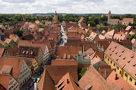
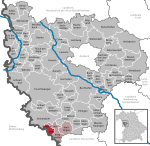
Dinkelsbühl (German pronunciation: [ˈdɪŋkl̩sˌbyːl] ) is a historic town in Central Franconia, a region of Germany that is now part of the state of Bavaria, in southern Germany. Dinkelsbühl is a former free imperial city of the Holy Roman Empire. In local government terms, Dinkelsbühl lies near the western edge of the Landkreis (or local government district) of Ansbach, north of Aalen. Dinkelsbühl lies on the northern part of the Romantic Road, and is one of three particularly striking historic towns on the northern part of the route, the others being Rothenburg ob der Tauber and Nördlingen. The town lies on the southern edge of the Franconian Heights and on the River Wörnitz, which rises in the town of Schillingsfürst. The population in 2013 was 11,315.
Excerpt from the Wikipedia article Dinkelsbühl (License: CC BY-SA 3.0, Authors, Images).Dinkelsbühl
Dr.-Martin-Luther-Straße,
Geographical coordinates (GPS) Address Nearby Places Show on map
Geographical coordinates (GPS)
| Latitude | Longitude |
|---|---|
| N 49.070833333333 ° | E 10.319444444444 ° |
Address
Dr.-Martin-Luther-Straße 6a
91550
Bavaria, Germany
Open on Google Maps


