Steeple Langford
Civil parishes in WiltshireEngvarB from July 2016Villages in Wiltshire

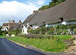
Steeple Langford is a village and civil parish in the English county of Wiltshire, 6 miles (10 km) northwest of Wilton. It has also been called Great Langford or Langford Magna. The village lies on the north bank of the River Wylye, and is bypassed to the north by the A36 Warminster-Salisbury trunk road which follows the river valley. The parish includes two hamlets on the other side of the river: Hanging Langford and Little Langford (formerly a separate civil parish). To the west is the former settlement of Bathampton. Steeple Langford has thatched cottages, and several lakes created by the flooding of worked-out gravel pits.
Excerpt from the Wikipedia article Steeple Langford (License: CC BY-SA 3.0, Authors, Images).Steeple Langford
Salisbury Road,
Geographical coordinates (GPS) Address Nearby Places Show on map
Geographical coordinates (GPS)
| Latitude | Longitude |
|---|---|
| N 51.136 ° | E -1.947 ° |
Address
Salisbury Road
Salisbury Road
SP3 4NF , Steeple Langford
England, United Kingdom
Open on Google Maps


