place

Monte Bello Open Space Preserve

Midpeninsula Regional Open Space DistrictNature reserves in CaliforniaProtected areas of San Mateo County, CaliforniaProtected areas of Santa Clara County, CaliforniaSanta Cruz Mountains
Monte Bello Open Space Preserve

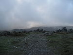
Monte Bello Open Space Preserve is a 3,133-acre (12.68 km2) open space preserve, located near Palo Alto in the Santa Cruz Mountains, in San Mateo and Santa Clara Counties, California, United States. The preserve encompasses the upper Stevens Creek watershed in the valley between Monte Bello Ridge and Skyline Ridge. "Monte Bello" means "beautiful mountain" in Italian, and refers to Black Mountain which is the highest part of Montebello Ridge. The straight valley of upper Stevens Creek is also the rift valley of the San Andreas Fault.

Excerpt from the Wikipedia article Monte Bello Open Space Preserve (License: CC BY-SA 3.0, Authors, Images).

Monte Bello Open Space Preserve
Alpine Road,

Geographical coordinates (GPS) Address Website External links Nearby Places
placeShow on map

Wikipedia: Monte Bello Open Space PreserveContinue reading on Wikipedia

Geographical coordinates (GPS)

Latitude Longitude
N 37.31 ° E -122.15 °
placeShow on map

Address

Monte Bello Open Space Preserve

Alpine Road

California, United States
mapOpen on Google Maps

Website
openspace.org

linkVisit website

linkWikiData (Q6904648)
linkOpenStreetMap (295763872)

Monte Bello Open Space Preserve
Share experience

Nearby Places

Los Trancos Open Space Preserve

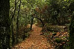
Los Trancos Open Space Preserve is a 274-acre (1.11 km2) open space preserve, located in San Mateo and Santa Clara Counties, California, near Los Altos Hills, California. The preserve contains about 5 miles (8 km) of hiking trails, of which 2.1 miles (3.4 km) are open to equestrians, and none are open to bicycles. The area was once a part of a 13,300 acre (53.8 km2) rancho. The preserve's acreage was purchased by state senator Louis Oneal in the early 1900s, who raised horses there. It was sold to a developer in the 1950s. Power and water lines were run to the property in the 1960s, but development was abandoned when the city of Palo Alto discovered the high cost of providing city services to the area. The preserve was acquired by the Midpeninsula Regional Open Space District in 1976. While the preserve is relatively small compared to other preserves and parks in the area, it has one notable feature: about one mile (1.5 km) of the San Andreas Fault runs underneath it. Several series of markers throughout the preserve indicate where the ground has broken during various earthquakes. Additionally, a 1.5-mile (2.4 km) trail follows the main break caused by the 1906 San Francisco earthquake. This trail includes several interpretive stations that point out various quake-caused features and phenomenon. Guided "quake walks" are held about once a month. Just northwest of Page Mill Road, the preserve protects the headwaters of Los Trancos Creek, a tributary of San Francisquito Creek.