place

Electorate of Mainz

1803 disestablishments in the Holy Roman Empire780 establishmentsDioceses established in the 8th centuryElectoral Rhenish CircleElectorate of Mainz
Electorates of the Holy Roman EmpireFormer monarchies of EuropeFormer states and territories of BavariaFormer states and territories of HesseFormer states and territories of Rhineland-PalatinateHistory of Catholicism in GermanyHistory of MainzPrince-bishoprics of the Holy Roman Empire in Germany
Banner of the Electorate of Mainz

The Electorate of Mainz (German: Kurfürstentum Mainz or Kurmainz, Latin: Electoratus Moguntinus), previously known in English as Mentz and by its French name Mayence, was one of the most prestigious and influential states of the Holy Roman Empire. In the Roman Catholic hierarchy, the Archbishop-Elector of Mainz was also the Primate of Germany (primas Germaniae), a purely honorary dignity that was unsuccessfully claimed from time to time by other archbishops. There were only two other ecclesiastical Prince-electors in the Empire: the Electorate of Cologne and the Electorate of Trier. The Archbishop-Elector of Mainz was also archchancellor of Germany (one of the three component titular kingdoms of the Holy Roman Empire, the other two being Italy and Burgundy) and, as such, ranked first among all ecclesiastical and secular princes of the Empire, and was second only to the Emperor. His political role, particularly as an intermediary between the Estates of the Empire and the Emperor, was considerable.

Excerpt from the Wikipedia article Electorate of Mainz (License: CC BY-SA 3.0, Authors, Images).

Electorate of Mainz
Große Langgasse, Mainz Altstadt

Geographical coordinates (GPS) Address Nearby Places
placeShow on map

Wikipedia: Electorate of MainzContinue reading on Wikipedia

Geographical coordinates (GPS)

Latitude Longitude
N 50 ° E 8.2666666666667 °
placeShow on map

Address

Große Langgasse 9
55116 Mainz, Altstadt
Rhineland-Palatinate, Germany
mapOpen on Google Maps

Banner of the Electorate of Mainz
Share experience

Nearby Places

Mont-Tonnerre
Mont-Tonnerre

Mont-Tonnerre [mɔ̃.tɔ.nɛʁ] was a department of the First French Republic and later the First French Empire in present-day Germany. It was named after the highest point in the Palatinate, the Donnersberg ("Thunder Mountain", possibly referring to Donar, god of thunder). It was the southernmost of four departments formed in 1797 when the west bank of the Rhine was annexed by France. Prior to the French occupation, its territory was divided between the Archbishopric of Mainz, the Bishopric of Speyer, the Bishopric of Worms, Nassau-Weilburg, Hesse-Darmstadt, the Electorate of the Palatinate and the imperial cities of Worms and Speyer. Its territory is now part of the German states of Rhineland-Palatinate and Saarland. Its capital was Mainz (French: Mayence). The department was subdivided into the following arrondissements and cantons (situation in 1812): Mainz, cantons: Alzey, Bingen, Bechtheim, Kirchheimbolanden, Mainz (2 cantons), Nieder-Olm, Ober-Ingelheim, Oppenheim, Wöllstein and Wörrstadt. Kaiserslautern (French: Kayserslautern), cantons: Göllheim, Kaiserslautern, Lauterecken, Obermoschel, Otterberg, Rockenhausen, Winnweiler and Wolfstein. Speyer (French: Spire), cantons: Dürkheim, Edenkoben, Frankenthal, Germersheim, Grünstadt, Mutterstadt, Neustadt, Pfeddersheim, Speyer and Worms. Zweibrücken (French: Deux-Ponts), cantons: Annweiler, Homburg, Landstuhl, Medelsheim, Neuhornbach, Pirmasens, Waldfischbach and Zweibrücken.Its population in 1812 was 342,316.After Napoleon was defeated in 1814, the department was divided between the Kingdom of Bavaria (Palatinate) and the Grand Duchy of Hesse (around Mainz).

Osteiner Hof
Osteiner Hof

The Osteiner Hof ("Court of Ostein") is one of several Baroque-era palatial mansions along Schillerplatz square in the German city of Mainz. The mansion, along the southern edge of the square, was built in 1747-1752 by architect-soldier Johann Valentin Thomann for Franz Wolfgang Damian von Ostein, brother of Johann Friedrich Karl von Ostein, who was prince-bishop of Mainz at that time. Characteristic features for this building are the three round protrusions (risalits) at the front entrance and on the two corners. The building is lavishly decorated; for instance, the windows are framed by rococo-style cartouches symbolising the elements of air, earth and water. The classical gods Diana and Mars are shown on the cartouches framing the balcony doors. The von Osteins, a dynasty of counts, were not able to make use of the mansion for very long. After the left bank of the Rhine was occupied by French Revolutionary armies, the mansion was appropriated by the state, and in 1798 it became the seat of a newly created département of France, Mont-Tonnerre. The building continued to be used as a seat of government after the Napoleonic era, even gaining the nickname Gouvernement during the years 1854-1859, while emperor-to-be Wilhelm I was serving as military governor of Mainz. During the early days of the Franco-Prussian War (1870–1871), the Osteiner Hof served as military headquarters of a Prussian field marshal, Prince Frederick Charles of Prussia. In 1914, then-military governor General Hugo von Kathen announced the start of World War I to the Mainz populace from the balcony of the Osteiner Hof. The mansion was destroyed by fire during World War II, but was restored in 1947-1948. From 1958 until 2014, the Osteiner Hof was in use by the Bundeswehr as military headquarters and officers' mess. The Osteiner Hof plays an important part in the local carnival traditions. Every year, on 11 November at 11 past 11, the start of the carnival season is proclaimed from the balcony of the mansion.

Battle of Mainz
Battle of Mainz

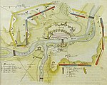
The Battle of Mainz (29 October 1795) saw a Habsburg Austrian army led by Field Marshall François Sebastien Charles Joseph de Croix, Count of Clerfayt launch a surprise assault against four divisions belonging to the French Army of Rhin-et-Moselle directed by General of Division François Ignace Schaal. The right-most French division was completely routed and all the French troops were compelled to retreat with the loss of their siege artillery and many casualties. Clerfayt followed up his Rhine campaign of 1795 victory by driving most of General of Division Jean-Charles Pichegru's Army of Rhin-et-Moselle south. The War of the First Coalition action was fought near the city of Mainz in the modern-day state of Rhineland-Palatinate in Germany. French troops had ineffectively besieged the western side of Mainz Fortress since December 1794. However, in early September 1795 the General of Division Jean-Baptiste Jourdan's Army of Sambre-et-Meuse crossed the lower Rhine River and advanced south to the Main River. For the first time Mainz was besieged on the east side of the river, but this state of affairs did not last long. After the Battle of Höchst, Clerfayt forced Jourdan's army to retire to the west bank of the Rhine. With Jourdan temporarily out of the picture, Clerfayt fell on Schaal's somewhat isolated corps and drove it away to the south. During this time the commander of the Army of Rhin-et-Moselle, Pichegru was in treasonous contact with France's enemies, perhaps accounting for Austria's success. The next clash was the Battle of Pfeddersheim on 10 November. The siege was the second time balloon reconnaissance had been used, after the Battle of Fleurus (1794).