Tatton, Cheshire
Borough of Cheshire EastCheshire geography stubsFormer civil parishes in Cheshire

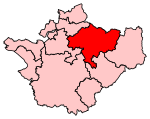
Tatton is a former civil parish, now in the parish of Millington and Rostherne, in the Cheshire East district and ceremonial county of Cheshire in England. It lay to the north of Knutsford and mostly covered Tatton Park. At the 2001 census, it had a population of 35. The parish did not have a parish council.
Excerpt from the Wikipedia article Tatton, Cheshire (License: CC BY-SA 3.0, Authors, Images).Tatton, Cheshire
Knutsford Drive,
Geographical coordinates (GPS) Address Nearby Places Show on map
Geographical coordinates (GPS)
| Latitude | Longitude |
|---|---|
| N 53.325 ° | E -2.371 ° |
Address
Tatton Park, Knutsford Drive / Old Hall
Knutsford Drive
WA16 6HS , Millington and Rostherne
England, United Kingdom
Open on Google Maps

