place

Presidio of Santa Barbara

1782 establishments in Alta California1782 in Alta California1966 establishments in CaliforniaArchaeological sites in CaliforniaBuildings and structures in Santa Barbara, California
California Historical LandmarksCalifornia State Historic ParksCalifornia presidiosForts on the National Register of Historic Places in CaliforniaGovernment buildings completed in 1782Historic preservation organizations in the United StatesHistory museums in CaliforniaHistory of Santa Barbara County, CaliforniaMuseums in Santa Barbara, CaliforniaNational Register of Historic Places in Santa Barbara County, CaliforniaParks in Santa Barbara, CaliforniaProtected areas established in 1966Spanish Colonial architecture in California
SB Presidio
SB Presidio

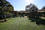
El Presidio Real de Santa Bárbara, also known as the Royal Presidio of Santa Barbara, is a former military installation in Santa Barbara, California, United States. The presidio was built by Spain in 1782, with the mission of defending the Second Military District in California. In modern times, the Presidio serves as a significant tourist attraction, museum and an active archaeological site as part of El Presidio de Santa Barbara State Historic Park.The park contains an original adobe structure called El Cuartel, which is the second oldest surviving building in California; only the chapel at Mission San Juan Capistrano, known as "Father Junípero Serra's Church", is older. The Presidio of Santa Barbara has the distinction of being the last military outpost built by Spain in the New World. The Presidio became a California Historical Landmark in 1958 and was listed on the U.S. National Register of Historic Places in 1973.

Excerpt from the Wikipedia article Presidio of Santa Barbara (License: CC BY-SA 3.0, Authors, Images).

Presidio of Santa Barbara
East Canon Perdido Street, Santa Barbara

Geographical coordinates (GPS) Address Nearby Places
placeShow on map

Wikipedia: Presidio of Santa BarbaraContinue reading on Wikipedia

Geographical coordinates (GPS)

Latitude Longitude
N 34.422566666667 ° E -119.6971 °
placeShow on map

Address

East Canon Perdido Street 222
93101 Santa Barbara
California, United States
mapOpen on Google Maps

SB Presidio
SB Presidio
Share experience

Nearby Places

Casa de la Guerra
Casa de la Guerra

The Casa de la Guerra was the residence of the fifth commandant of the Presidio de Santa Barbara, José de la Guerra y Noriega, founder of the Guerra family of California (a prominent Californio family) from 1828 until his death in 1858. Descendants of José lived in the home until 1943. The site is currently owned and operated by the Santa Barbara Trust for Historic Preservation as a historic house museum. The address is 15 East De la Guerra Street, Santa Barbara, California. The time when José lived in the casa it was known to locals as the casa grande (big house), as the thirteen room structure dwarfed the surrounding one room adobes. In the casa grande period, José added the altito structure. The altito structure no longer stands, but acted as José's office and was where he stored his money. The 1857 Fort Tejon earthquake did significant damage to the residence, and due to José's declining health, his son Pablo spearheaded renovations. Pablo's renovations reflected the change in style in the Santa Barbara area, modifying the home to give it a Victorian appearance. The most significant changes in this time were the removal of the adobe columns in favor of wooden columns and the addition of wooden siding to the house. The Casa is a Santa Barbara City Landmark, a California Historical Landmark. It is listed on the National Register of Historic Places together with Paseo de la Guerra as "El Paseo and Casa de la Guerra". The house is being restored and furnished to appear as it might have between 1828 and 1858. The Casa de la Guerra interior is open to visitors Saturdays and Sundays, although the exterior may be explored any time.