Bass Point (England)
Headlands of CornwallHistory of radio in the United KingdomIndustrial archaeological sites in CornwallLizard PeninsulaNational Trust properties in Cornwall

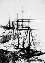
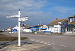
Bass Point is a headland on the coast of Cornwall, England. It is at the southern tip of the Lizard peninsula, in the civil parish of Landewednack. The headland was a communications centre during the Victorian era, with the Lloyds Signal Station, opened in 1872 for shore to ship communications, and Marconi's experiments with wireless at the Lizard Wireless Station.
Excerpt from the Wikipedia article Bass Point (England) (License: CC BY-SA 3.0, Authors, Images).Bass Point (England)
Lloyds Road,
Geographical coordinates (GPS) Address External links Nearby Places Show on map
Geographical coordinates (GPS)
| Latitude | Longitude |
|---|---|
| N 49.963333333333 ° | E -5.1866666666667 ° |
Address
Bass Point Station
Lloyds Road
TR12 7AP
England, United Kingdom
Open on Google Maps


