Marienfeld
Geography of Cologne

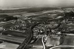
Marienfeld is a large (2.6 km2 / 640 acres) grassy field on the reclaimed site of a former open-pit lignite mine about 20 km (12 mi) south-west of Cologne Cathedral in the city of Cologne, Germany, straddling the towns of Frechen and Kerpen. The mine area was named Marienfeld (German: Mary's Field) and landscaped in order to serve as the site of the Catholic Church's 20th World Youth Day in 2005.
Excerpt from the Wikipedia article Marienfeld (License: CC BY-SA 3.0, Authors, Images).Marienfeld
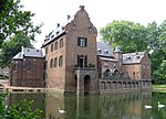
An Burg Mödrath,
Geographical coordinates (GPS) Address Nearby Places Show on map
Geographical coordinates (GPS)
| Latitude | Longitude |
|---|---|
| N 50.883333333333 ° | E 6.7333333333333 ° |
Address
Gut Mödrath
An Burg Mödrath
50171
North Rhine-Westphalia, Germany
Open on Google Maps


