place

Salinas River National Wildlife Refuge

1974 establishments in CaliforniaIUCN Category IVLandforms of Monterey County, CaliforniaMonterey BayNational Wildlife Refuges in California
Protected areas established in 1974Protected areas of Monterey County, CaliforniaSalinas River (California)Tourist attractions in Monterey County, CaliforniaWetlands of California
Salinas River National Wildlife Refuge fishing

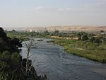
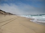
Salinas River National Wildlife Refuge is located approximately 11 miles north of Monterey, California, and 3 miles south of Castroville, California, at the point where the Salinas River empties into Monterey Bay. The 367-acre (1.49 km2) refuge encompasses several habitat types including sand dunes, pickleweed salt marsh, river lagoon, riverine habitat, and a saline pond. The refuge was established in 1974 because of its "particular value in carrying out the national migratory bird management program."The area provides habitat for several threatened and endangered species, including the California brown pelican, Smith's blue butterfly, the western snowy plover, the Monterey sand gilia, and the Monterey spineflower. The refuge is used by a variety of migratory birds during breeding, wintering, and migrating periods. Refuge mammals include muskrat, golden beaver, gray fox, red fox, striped skunk, longtail weasel, Virginia opossum, vagrant shrew, broad-footed mole, brush rabbit, raccoon, duskyfooted woodrat, deer mouse, and coyote.Salinas River National Wildlife Refuge is open to the public though there are no facilities beyond a parking lot and footpaths. Dogs, horseback riding, and camping are not permitted due to the sensitivity of the habitat.

Excerpt from the Wikipedia article Salinas River National Wildlife Refuge (License: CC BY-SA 3.0, Authors, Images).

Salinas River National Wildlife Refuge

Geographical coordinates (GPS) Address Nearby Places
placeShow on map

Wikipedia: Salinas River National Wildlife RefugeContinue reading on Wikipedia

Geographical coordinates (GPS)

Latitude Longitude
N 36.74162 ° E -121.80384 °
placeShow on map

Address

Monterey County (Monterey)


California, United States
mapOpen on Google Maps

Salinas River National Wildlife Refuge fishing
Share experience

Nearby Places

Monterey Canyon
Monterey Canyon

Monterey Canyon, or Monterey Submarine Canyon, is a submarine canyon in Monterey Bay, California with steep canyon walls measuring a full 1 mile (1.6 km) in height from bottom to top, which height/depth rivals the depth of the Grand Canyon itself. It is the largest such submarine canyon along the West coast of the North American continent, and was formed by the underwater erosion process known as turbidity current erosion. Many questions remain unresolved regarding the exact nature of its origins, and as such it is the subject of several ongoing geological and marine life studies being carried out by scientists stationed at the nearby Monterey Bay Aquarium Research Institute, the Moss Landing Marine Laboratories, and other oceanographic institutions. Monterey Canyon begins at Moss Landing, California, which is situated along the middle of the coast of Monterey Bay, and extends horizontally 95 mi (153 km) under the Pacific Ocean where it terminates at the Monterey Canyon submarine fan, reaching depths of up to 3,600 m (11,800 ft) below surface level at its downstream mouth. It is a part of the greater Monterey Bay Canyon System, which consists of Monterey, Soquel and Carmel Canyons. The canyon's depth and nutrient availability (due to the regular influx of nutrient-rich sediment) provide a habitat suitable for many marine life forms. The Soquel Canyon State Marine Conservation Area protects a side-branch of the Monterey Submarine Canyon. Like an underwater park, this marine protected area helps conserve ocean wildlife and marine ecosystems.