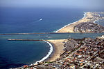
Corona del Mar, Newport Beach

Corona del Mar (Spanish for "Crown of the Sea") is a seaside neighborhood in the city of Newport Beach, California. It generally consists of all the land on the seaward face of the San Joaquin Hills south of Avocado Avenue to the city limits, as well as the development of Irvine Terrace, just north of Avocado. Corona del Mar is known for its beaches, tidepools, cliffside views and village shops. Beaches in the area include Corona del Mar State Beach as well as Crystal Cove State Park south of Corona del Mar, accessible by paths winding down a steep hillside. Corona del Mar has a representative to the Newport Beach City Council. Some residents use a mailing address of Corona del Mar with the 92625 ZIP code.
Excerpt from the Wikipedia article Corona del Mar, Newport Beach (License: CC BY-SA 3.0, Authors, Images).Corona del Mar, Newport Beach
Ocean Boulevard,
Geographical coordinates (GPS) Address Nearby Places Show on map
Geographical coordinates (GPS)
| Latitude | Longitude |
|---|---|
| N 33.588633 ° | E -117.878945 ° |
Address
Ocean Boulevard 2919
92625 , Corona del Mar
California, United States
Open on Google Maps


