Gera

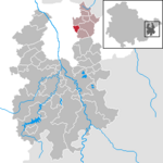
Gera is a city in the German state of Thuringia. With around 93,000 inhabitants, it is the third-largest city in Thuringia after Erfurt and Jena as well as the easternmost city of the Thüringer Städtekette, an almost straight string of cities consisting of the six largest Thuringian cities from Eisenach in the west, via Gotha, Erfurt, Weimar and Jena to Gera in the east. Gera is the largest city in the Vogtland, and one of its historical capitals along with Plauen, Greiz and Weida. The city lies in the East Thuringian Hill Country, in the wide valley of the White Elster, between Greiz (upstream) and Leipzig (downstream). Gera is located in the Central German Metropolitan Region, approximately 60 kilometres (37 miles) south of Saxony's largest city of Leipzig, 80 km (50 miles) east of Thuringia's capital Erfurt, 120 km (75 miles) west of Saxony's capital Dresden and 90 km (56 miles) north of Bavaria's city of Hof (Saale). First mentioned in 995 and developing into a city during the 13th century, Gera has historical significance as being one of the main residences of the Ducal House of Reuss and subsequently the capital of the Principality of Reuss-Gera (1848-1918) and of the People's State of Reuss (1918-1920), one of the many microstates the Thuringian region consisted of, before they were unified to form Thuringia in 1920. Over the 19th century, Gera became a centre of the textile industry and saw a period of rapid growth. In 1952, the city also became an administrative centre in GDR as one of the capitals of Gera administrative district (Bezirk). In 1990, Gera became part of re-established Thuringia. The loss of its administrative functions as well as its industrial core (caused both by structural change among the European textile industry and the economic system change after the German reunification) precipitated the city's slide into an enduring economic crisis. Since 1990, many of Gera's buildings have been restored and big urban planning programmes like the Bundesgartenschau 2007 were implemented to stimulate Gera's economy. Sights include some retained buildings of the royal residence epoque and many public and private buildings from the economic heyday between 1870 and 1930. The famous painter Otto Dix was born in Gera in 1891.
Excerpt from the Wikipedia article Gera (License: CC BY-SA 3.0, Authors, Images).Gera
Clara-Zetkin-Straße,
Geographical coordinates (GPS) Address Nearby Places Show on map
Geographical coordinates (GPS)
| Latitude | Longitude |
|---|---|
| N 50.880555555556 ° | E 12.083333333333 ° |
Address
Villa Böhnert
Clara-Zetkin-Straße 16
07545 , Ostviertel
Thuringia, Germany
Open on Google Maps

