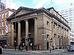
Mosley Street
Streets in ManchesterUse British English from October 2017

Mosley Street is a street in Manchester, England. It runs between its junction with Piccadilly Gardens and Market Street to St Peter's Square. Beyond St Peter's Square it becomes Lower Mosley Street. It is the location of several Grade II and Grade II* listed buildings. Mosley Street tram stop was located near Piccadilly Gardens. In 2009, the tram lines were reconstructed, and buses used Mosley Street en route to Piccadilly Gardens until May 2011, when they were rerouted along Portland Street. The street is now exclusively used by Metrolink trams and no cars are permitted on the street. The tram stop closed on 17 May 2013.
Excerpt from the Wikipedia article Mosley Street (License: CC BY-SA 3.0, Authors, Images).Mosley Street
Mosley Street, Manchester City Centre
Geographical coordinates (GPS) Address Nearby Places Show on map
Geographical coordinates (GPS)
| Latitude | Longitude |
|---|---|
| N 53.47948 ° | E -2.24112 ° |
Address
Mosley Street
Mosley Street
M2 3HZ Manchester, City Centre
England, United Kingdom
Open on Google Maps


