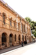
Shmuel HaNavi (neighborhood)
Neighbourhoods of Jerusalem

Shmuel HaNavi (Hebrew: שיכון שמואל הנביא, Shikun Shmuel HaNavi, lit. "Samuel the Prophet neighborhood") is a neighborhood in north-central Jerusalem. It is bordered by the Sanhedria Cemetery to the north, Maalot Dafna to the east, Arzei HaBira to the south, and the Bukharan Quarter to the west. It is named after Shmuel HaNavi (Samuel the Prophet) Street, which runs along its western border and is the main road leading to the tomb of Samuel the prophet (Hebrew: Shmuel HaNavi) just outside Jerusalem's city limits.
Excerpt from the Wikipedia article Shmuel HaNavi (neighborhood) (License: CC BY-SA 3.0, Authors, Images).Shmuel HaNavi (neighborhood)
Magen Ha'Elef, Jerusalem Maalot Dafna
Geographical coordinates (GPS) Address Nearby Places Show on map
Geographical coordinates (GPS)
| Latitude | Longitude |
|---|---|
| N 31.795 ° | E 35.222222222222 ° |
Address
Magen Ha'Elef
9522901 Jerusalem, Maalot Dafna
Jerusalem District, Israel
Open on Google Maps


