Hils
Central UplandsHill ranges of Lower SaxonyLower Saxony geography stubsNatural regions of the Weser-Leine UplandsRegions of Lower Saxony

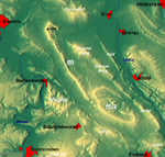
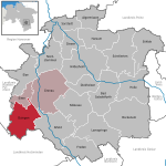
The Hils is a range of hills in Germany's Central Uplands that is up to 480.4 m high. It is located in the districts of Holzminden, Hildesheim and Northeim, in the state of Lower Saxony.
Excerpt from the Wikipedia article Hils (License: CC BY-SA 3.0, Authors, Images).Hils
L 484, Grünenplan
Geographical coordinates (GPS) Address Nearby Places Show on map
Geographical coordinates (GPS)
| Latitude | Longitude |
|---|---|
| N 51.933333333333 ° | E 9.75 ° |
Address
Idtberg
L 484
31073 Grünenplan
Lower Saxony, Germany
Open on Google Maps


