place

Egg Rock Light (Massachusetts)

Lighthouses completed in 1856Lighthouses completed in 1898Lighthouses in Essex County, Massachusetts
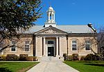
Egg Rock Lighthouse 1898 Massachusetts

Egg Rock Light was first established in 1856 after a schooner went down with the loss of five lives. The original structure was a lantern on top of a stone dwelling built from granite cut on the island. After the wreck of the schooner Shark the characteristic was changed to fixed red because the captain of the Shark was said to have confused it with Long Island Head Light in Boston Harbor. Following a fire in 1897 it was rebuilt with a square tower attached to the house. The light was operated at reduced intensity during World War I because of concerns over German submarines. It was automated in 1919 when a gas beacon replaced the oil light. The structure was sold for $160 with a clause requiring the purchaser to remove it from the island. While moving the house down to the water, a cable snapped and the house slid into the water. The tower was destroyed in 1927. The island is now a bird sanctuary.

Excerpt from the Wikipedia article Egg Rock Light (Massachusetts) (License: CC BY-SA 3.0, Authors, Images).

Egg Rock Light (Massachusetts)
Spouting Horn Road,

Geographical coordinates (GPS) Address Nearby Places
placeShow on map

Wikipedia: Egg Rock Light (Massachusetts)Continue reading on Wikipedia

Geographical coordinates (GPS)

Latitude Longitude
N 42.433333333333 ° E -70.898055555556 °
placeShow on map

Address

Henry Cabot Lodge Wildlife Sanctuary

Spouting Horn Road
01908
Massachusetts, United States
mapOpen on Google Maps

Egg Rock Lighthouse 1898 Massachusetts
Share experience

Nearby Places

Henry Cabot Lodge House

The Henry Cabot Lodge House is a National Historic Landmark at 5 Cliff Street in Nahant, Massachusetts. It was designated as the only known residential building associated with United States Senator Henry Cabot Lodge (1850–1924). Lodge was a leading Republican politician who was a longtime associate of President Theodore Roosevelt, and an influential figure who led the successful opposition to the ratification of the Treaty of Versailles that ended World War I.It is unclear exactly when and for whom the Henry Cabot Lodge House was built. It was known to be owned by Lodge's grandfather Henry in 1850, although local historians believe it was built c. 1820 by Lodge's father John. Stylistically the house is unusual for New England, and is based on a type of plantation house popular in the West Indies in the late 19th century. The house was used by the Lodge family as a summer house after the main Lodge residence (since torn down) was built at Nahant's East Point, and both Lodge and his like-named grandson reported spending childhood years at the house. The house was sold out of the Lodge family after the elder Lodge's death.The house is a two-story brick structure measuring about 50 feet (15 m) by 48 feet (15 m), resting on a brick foundation that is set in a low artificial earthen mound. The exterior walls have been stuccoed, and the roof is a low pitch hip roof pierced by four slender chimneys. The building is encircled by a two-story veranda, which is sheltered by the roof and supported by twelve latticework pillars (four at the corners and two additional ones on each side). On the western corner of the first floor the veranda has been closed in to provide a sun room.The house was designated a National Historic Landmark and listed on the National Register of Historic Places in 1976.

New Ocean House
New Ocean House

The New Ocean House was an American hotel located in Swampscott, Massachusetts. The hotel was built in 1888 to replace an earlier hotel that had been destroyed by fire. In 1902 it was purchased by Allen Ainslie of the Maplewood Hotel in Bethlehem, New Hampshire and Edward R. Grabow of The Buckminster, who enlarged, renovated, and refurnished the building, which they renamed the New Ocean House. The pair added 50 rooms (34 of which had private bathrooms) to bring the total to 210. The entire first floor was redone and included an elegant rotunda and lobby. Electricity was run throughout the entire building. In 1922, a steel and concrete annex was completed, bringing the total number of rooms to 300. By 1923, the property had grown from 3 acres to 19, was doing $400,000 worth of business annually, and valued at $1.3 million. From 1926 to 1959 the New Ocean House was run by Clement Kennedy, who managed the New Ocean House during the summer and Vinoy Park Hotel in St. Petersburg, Florida during the winter.The New Ocean House had a private beach directly in front of the hotel, 25 acres of lawns and gardens, a saltwater swimming pool, tennis courts, and a pitch and putt course. The first floor contained a butcher shop, fish market, barber shop, bakery, drug store, tailor, and laundry. It was a center of social activity on the North Shore, hosting dances, conventions, reunions, concert, vaudeville shows, and tennis tournaments. Rudy Vallée performed at the New Ocean House early in his career.The hotel hosted a number of celebrities, including Will Rogers, Harpo Marx, Lucille Ball, Helen Keller, Faith Baldwin, Alexander Woollcott, Louise Whitfield Carnegie, Babe Ruth, Florence Chadwick, John F. Kennedy, William Jennings Bryan, Henry F. Ashurst, and Carlos P. Romulo. It also served as headquarters for White House staff during Calvin Coolidge’s 1925 stay at nearby White Court, during John Aspinwall Roosevelt and Anne Lindsay Clark's 1938 wedding in Nahant, Massachusetts, and during the 1941 Atlantic Charter conference between Franklin D. Roosevelt and Winston Churchill.In 1959, the hotel was purchased by a group led by Boston industrialist Harold A. Rudnick. In 1965 it was sold to Dr. George Rohrborough.On May 8, 1969, the New Ocean House was destroyed by a fire. There were no guests at the time of the fire and only a clerk and three kitchen workers were in the building when the fire started. The fire started in the rear of the building and the first alarm was struck at 9:53 p.m. The hotel's sprinkler system and misty air helped suppress the fire and firefighters initially thought the fire could be contained. However, intense heat forced them back and the fire spread along the roof to the front of the building. Firefighting efforts were hampered by narrow streets and low water pressure and by 12:30 a.m. the fire had spread across the entire 300-foot front of the building. By 1 am the fire was out of control. Crews from 25 communities fought the blaze, which was not put out until 2:48 p.m. on May 10. No cause was determined, however a hotel spokesperson stated that it may have started in a staging area erected for plumbing work. After the fire, the hotel was replaced by 30 houses in 2 streets. Puritan Rd(where the entrance/lobby was)to Sutton Pl(the middle to back part of the hotel)

Fort Ruckman
Fort Ruckman

Fort Ruckman was a U.S. Coast Artillery fort located in Nahant, Massachusetts. Originally called the Nahant Military Reservation, the fort was laid out in 1904-1907 and covered an area of about 45 acres just northwest of Bass Point, on the southwest side of the Nahant peninsula. During the 1920s, this area was renamed in honor of Maj. Gen. John Wilson Ruckman, a former Colonel in the Coast Artillery.The fort was decommissioned after World War II and the property was sold to the town and to private owners beginning in about 1947. The fire control tower indicated on the map was used as part of the Army/Lincoln Labs Nike program-related radar research and development during the late 1940s and early 1950s and at one point had a large radar antenna on its roof. A Nike target tracking radar was also erected on Bayley's Hill (the eastern edge of the fort) during the 1950s. During World War II, Fort Ruckman was part of the Harbor Defenses of Boston, and housed the Group Command post for the northern district of the harbor defense artillery and Battery Gardner, two 12-inch guns in east-facing casemates of reinforced concrete. These casemates were built just before WW2 over the open (surface) gun positions originally completed in 1923.The guns were the 12-inch M1895 gun, on Model 1917 long-range barbette carriages. When they were installed, these were the largest caliber guns in the harbor defenses. Each gun a total weight of 151 tons and had a maximum range of about 29,300 yards (about 16.6 miles). This would enable the guns, for example, to cover an arc extending from Gloucester in the north to North Scituate in the south. The centers of the two gun positions are roughly 425 ft. apart. Today, most of the area within the fort's World War II boundaries has been converted into residential real estate, recreation, or park land for the Town of Nahant. The extensive concrete galleries between the north and south firing positions which housed fire control activities, ammunition storage, and crew quarters, have been buried under 20 or so feet of earth during the casemate construction process. These subterranean galleries are still accessible and are used by the Town for storage. On the surface of the buried galleries are a series of large and smaller concrete chimneys that ventilate the galleries below. A geodetic marker, MY0039—RUCKMAN RESET (see photo at left), was emplaced in 1943, likely as a point of reference for aiming the 12" guns. About 800 ft. NNW of the northernmost gun position of Battery Gardner lay the center of a 3-gun battery of antiaircraft guns known as Location 130-2C, or the Boston Harbor No.4 AAA Battery. The three guns were surface-mounted, standard barbette carriage 3" guns, Model 1917A2. The gun centers formed a roughly equilateral triangle 150 ft. on a side. The gun positions were constructed in 1934, but were not armed until 1942. Final construction on the battery commenced on May 5, 1942, and was completed in less than a month. Today, the battery positions appear (from Google maps) to have been destroyed, but the center point of the battery would fall roughly at the left field foul pole of the first baseball field southeast of the corner of Castle and Flash Roads.