Forest of Leeds
Forests and woodlands of West YorkshireLeedsWest Yorkshire geography stubs

The Forest of Leeds was originally the Forest of Loidis in which today's city of Leeds arose. It now refers to patches of woodland throughout the metropolitan district, managed by Leeds City Council amounting to 1200 hectares. These are in 55 units of various kinds of woodlands, including those of Belle Isle, Gledhow, Golden Acre Park, Lotherton Hall, Meanwood Valley, Middleton Park, Moortown, Roundhay Park, Temple Newsam and Woodhouse Ridge, formed as a forest in 1993.
Excerpt from the Wikipedia article Forest of Leeds (License: CC BY-SA 3.0, Authors, Images).Forest of Leeds
Victoria Gardens, Leeds Holbeck Urban Village
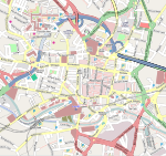
Geographical coordinates (GPS) Address Nearby Places Show on map
Geographical coordinates (GPS)
| Latitude | Longitude |
|---|---|
| N 53.8 ° | E -1.549 ° |
Address
Victoria Gardens
Victoria Gardens
Leeds, Holbeck Urban Village
England, United Kingdom
Open on Google Maps


