place

Frenchay Road

England road stubsOxfordshire geography stubsStreets in OxfordUse British English from January 2017
Frenchay Road, Oxford

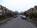
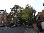
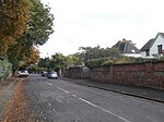
Frenchay Road is a residential road in Walton Manor, North Oxford, England.The oldest part of the road runs east–west. At the eastern end is a junction with Woodstock Road (A4144), a major arterial road out of Oxford to the north. Opposite and slightly to the south is Staverton Road. Chalfont Road leads south from halfway along the original part of the road. To the west is a junction with Bainton Road to the north and Hayfield Road to the south. The road continued over the Frenchay Road Bridge on the Oxford Canal, formerly to commercial premises by the railway line. More recently the road has been extended to the west of the canal with a bend to the north and newer residential development, The Waterways housing estate dating from 2000 to 2006, doubling the length of the road. Immediately to the southwest of Frenchay Road Bridge on the canal is the entrance to the Trap Grounds nature reserve. All the original houses were designed by the leading North Oxford architect Harry Wilkinson Moore and were first leased between 1897 and 1906. Many were built by John Money. The road forms the approximate northern boundary of the original North Oxford development by St John's College, Oxford, along with Staverton Road and Marston Ferry Road to the east. The original houses were semi-detached residences. Newer homes are flats, maisonettes, and terraced houses.The Scottish educational missionary to Calcutta and Orientalist John Nicol Farquhar (1861–1929) lived at 11 Frenchay Road. The road is mentioned in the book A Death in Oxford by Richard MacAndrew.

Excerpt from the Wikipedia article Frenchay Road (License: CC BY-SA 3.0, Authors, Images).

Frenchay Road
Frenchay Road, Oxford North Oxford

Geographical coordinates (GPS) Address Nearby Places
placeShow on map

Wikipedia: Frenchay RoadContinue reading on Wikipedia

Geographical coordinates (GPS)

Latitude Longitude
N 51.7704 ° E -1.2684 °
placeShow on map

Address

Frenchay Road

Frenchay Road
OX2 6TG Oxford, North Oxford
England, United Kingdom
mapOpen on Google Maps

Frenchay Road, Oxford
Share experience

Nearby Places

Lathbury Road
Lathbury Road

Lathbury Road is a short residential road in north Oxford, England. The road runs approximately east–west with a small curve halfway along. At the western end of the road is a junction with Woodstock Road (A4144) and at the eastern end is a junction with Banbury Road (A4165), the two major arterial roads out of Oxford to the north. To the south is Staverton Road and to the north is Moreton Road. It lies to the north of the original North Oxford development by St John's College, Oxford but since it is south of Summertown it is often considered to be part of Central North Oxford, with high house prices.The Bengali author and broadcaster Nirad Chaudhuri (1897–1999) lived at 20 Lathbury Road from 1982 to 1999. A blue plaque was installed by the Oxfordshire Blue Plaques Board in 2008. The jurist and international lawyer Sir Humphrey Waldock (1904–1981) lived at 6 Lathbury Road. The historian Ralph Henry Carless Davis (1918–1991) lived in Lathbury Road with his wife Eleanor. The philologist and Kafka authority, Sir Malcolm Pasley (1926-2004) lived at number 25 with his wife Virginia. Number 26, Elmswood, was built by the Arts and Craft architect Percy Richard Morley Horder for Ulric Vernon Herford (1866-1938). From a Unitarian family, Herford was consecrated as a bishop in the Syro-Chaldean (Nestorian) Church, and is considered one of the founders of Free Catholicism. Elmswood has a chapel and was more recently occupied by the linguist Maurice Pope (1926-2019). Other Lathbury road residents have included George Brownlee and Harriet Green. In the early 1980s, Williams College, a liberal arts college located in Williamstown, Massachusetts, United States, purchased a group of houses, today known as the Ephraim Williams House, on Banbury Road and Lathbury Road. The Williams-Exeter Programme was founded in 1985. Since that time, 26 undergraduate students from Williams College spend their junior year at Exeter College, Oxford each year as members of the college. The Nursery (for 2–5-year-old children) is located at 17 Lathbury Road. The main premises of St Clare's, an independent international boarding school founded in 1953, is also located at 139 Banbury Road, just to the north of Lathbury Road.

Aristotle Lane
Aristotle Lane

Aristotle Lane is a road in north Oxford, England.The lane links North Oxford, leading from the junction of Kingston Road and Hayfield Road (close to the junction with Polstead Road), with Port Meadow to the west, via bridges over the Oxford Canal and railway. The other access to the meadow from North Oxford is via Walton Well Road to the south. St Philip & St James Primary School is located in Aristotle Lane, having previously below in Leckford Road to the south. The Aristotle Lane Allotments are also located here. To the north of the allotments is the Burgess Field Nature Park, formerly a landfill site. In addition, there is a recreation ground.Aristotle Lane Wildlife Corridor which is located within the residential development site of Burgess Mead is a 0.25-hectare (0.62-acre) strip of land either side of a minor drainage channel which runs for some 154 metres through the site. Included is a narrow strip of land at the northern site boundary which buffers the site from the adjacent Trap Grounds. This is an area of reed and sedge beds enclosed by damp woodland dominated by willows. Its interest includes breeding water rail, reed warbler and reed bunting and it has a certain historical ornithological value due to a past history of bird ringing at the site, as well as it being the location of a television documentary about the cuckoo. The pond/wetland created as part of the development has been successful and currently supports a dense central area of tall emergent vegetation typified by common reed and purple loosestrife, with other species at the margins including water mint and marsh marigold. The grasslands within the wildlife corridor have their origins partly in wildflower seeding and partly due to turfing (a legacy of the developers’ sales team). Seed of guaranteed native local provenance was used to create species-rich grasslands . The mammal shelves of sand/concrete bags installed alongside the stream channel beneath the new bridge, which is designed to permit terrestrial wildlife movement along the entire length of the watercourse.