Sieges of Taunton

The sieges of Taunton were a series of three blockades during the First English Civil War. The town of Taunton, in Somerset, was considered to be of strategic importance because it controlled the main road from Bristol to Devon and Cornwall. Robert Blake commanded the town's Parliamentarian defences during all three sieges, from September 1644 to July 1645. The first siege was laid by Edmund Wyndham on 23 September, and was primarily composed of Royalist troops from local Somerset garrisons. After initial assaults drove Blake and his troops back into Taunton Castle, the blockade was conducted from 1–2 miles (1.6–3.2 km) away, and concentrated more on starving the garrison than continued attacks. The town was relieved by a force under James Holborne on 14 December. Over the next three months, Blake was able to establish a network of earthen defences in Taunton, including a basic perimeter and several forts. The Royalists began the second, and bloodiest, siege in late March 1645, initially under Sir Richard Grenville. A series of disputes between the Royalist commanders allowed Taunton some respite at the start of the siege, but in May the attacks were fierce under the command of Sir Ralph Hopton. After five days of intense fighting, which had once again driven the defending army back to a small central perimeter including the castle, the Royalists retreated in the face of a Parliamentarian relief army commanded by Ralph Weldon. Lord Goring, who had proposed the second siege, renewed the blockade for a third time in mid-May, after engaging Weldon's departing army and forcing it back into Taunton. Goring's siege was lax and allowed provisions into the town, diminishing its effectiveness. The Parliamentarian defence tied up Goring and his 10–15,000 troops, who would have otherwise been available to fight for King Charles at Naseby, where historians believe they could have tipped the battle in favour of the Royalists. Instead, after securing a Parliamentarian victory at Naseby, Thomas Fairfax marched his army to relieve Taunton on 9 July 1645.
Excerpt from the Wikipedia article Sieges of Taunton (License: CC BY-SA 3.0, Authors, Images).Sieges of Taunton
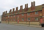
St James Street,
Geographical coordinates (GPS) Address Nearby Places Show on map
Geographical coordinates (GPS)
| Latitude | Longitude |
|---|---|
| N 51.019 ° | E -3.1 ° |
Address
County Ground
St James Street
TA1 1JT , Firepool
England, United Kingdom
Open on Google Maps


