Al-Barriyya
Arab villages depopulated during the 1948 Arab–Israeli WarDistrict of RamlaPages with non-numeric formatnum arguments

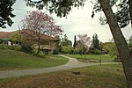
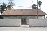
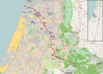
Al-Barriyya was a Palestinian village in the Ramle Subdistrict of Mandatory Palestine. It was depopulated during the 1948 Arab–Israeli War on July 10, 1948, as part of Operation Dani. It was located 5.5 km southeast of Ramla, on the eastern bank of Wadi al-Barriyya. The area of the destroyed village has been overbuilt by Beit Hashmonai.
Excerpt from the Wikipedia article Al-Barriyya (License: CC BY-SA 3.0, Authors, Images).Al-Barriyya
Yahanan HaGadi, Gezer Regional Council
Geographical coordinates (GPS) Address Nearby Places Show on map
Geographical coordinates (GPS)
| Latitude | Longitude |
|---|---|
| N 31.888055555556 ° | E 34.918333333333 ° |
Address
יוחנן הגדי
Yahanan HaGadi
Gezer Regional Council
Center District, Israel
Open on Google Maps


