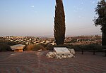
Barfiliya

Barfiliya (Arabic: برفيلية) was a Palestinian village located 10.5 kilometres (6.5 mi) east of Ramla that was depopulated during the 1948 Arab–Israeli War. Located on a tell, excavations conducted there by Israeli archaeologists beginning in 1995 found artifacts dating back to the Pre-Pottery Neolithic A (PPNA) period (circa 9,500-8,000 BCE). Barfiliya lay on a road between Jerusalem and Lydda that was built in Roman times. During the Crusades, it was known as Porfylia. In the early Ottoman era, it was a small village of 44 inhabitants. By 1945, before the end of the Mandatory Palestine and the outbreak of 1948 Arab–Israeli War, its population had grown to 730. Depopulated on July 14, 1948, Barifiliya was subsequently destroyed.
Excerpt from the Wikipedia article Barfiliya (License: CC BY-SA 3.0, Authors, Images).Barfiliya
Modiin-Maccabim-Reut Avnei Hen
Geographical coordinates (GPS) Address Nearby Places Show on map
Geographical coordinates (GPS)
| Latitude | Longitude |
|---|---|
| N 31.910833333333 ° | E 34.988333333333 ° |
Address
7177657 Modiin-Maccabim-Reut, Avnei Hen
Center District, Israel
Open on Google Maps


