Aqir
Arab villages depopulated during the 1948 Arab–Israeli WarDistrict of RamlaPages with non-numeric formatnum arguments

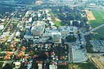
Aqir, also spelt Akir and Akkur, was a Palestinian Arab village in the Ramle Subdistrict, located 9 km southwest of Ramla and 1 km north of Wadi al-Nasufiyya (today called Nahal Ekron). It was depopulated and demolished and replaced by Kiryat Ekron.
Excerpt from the Wikipedia article Aqir (License: CC BY-SA 3.0, Authors, Images).Aqir
Kovshey HaHermon,
Geographical coordinates (GPS) Address Nearby Places Show on map
Geographical coordinates (GPS)
| Latitude | Longitude |
|---|---|
| N 31.859444444444 ° | E 34.820833333333 ° |
Address
כובשי החרמון
Kovshey HaHermon
7646016
Center District, Israel
Open on Google Maps


