place

Umm az-Zinat

Arab villages depopulated during the 1948 Arab–Israeli WarDistrict of HaifaPages with non-numeric formatnum arguments
Historical map series for the area of Umm az Zinat (1870s)

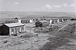
Umm az-Zinat (Arabic: أُم الزينات, Umm ez Zînât) was a Palestinian Arab village in the Haifa Subdistrict. It was depopulated during the 1948 War on May 15, 1948, by Golani Brigade's Fourth Battalion. It was located 20.5 km southeast of Haifa.

Excerpt from the Wikipedia article Umm az-Zinat (License: CC BY-SA 3.0, Authors, Images).

Umm az-Zinat
The Caves Path,

Geographical coordinates (GPS) Address Nearby Places
placeShow on map

Wikipedia: Umm az-ZinatContinue reading on Wikipedia

Geographical coordinates (GPS)

Latitude Longitude
N 32.648055555556 ° E 35.065277777778 °
placeShow on map

Address

The Caves Path
2069208
Haifa District, Israel
mapOpen on Google Maps

Historical map series for the area of Umm az Zinat (1870s)
Share experience

Nearby Places

Nahal Tut (archaeological site)

Nahal Tut (Hebrew: נחל תות, also Nachal Toot) is an archaeological site excavated along the streambed of the same name in northern Israel's Menashe Heights from February to July 2005 by Amir Gorzalczany and Gerald Finkielsztejn in preparation for the northward extension of Highway 6. Trig Point N-568 is situated south of Nahal Melah highway (Hwy 70) about halfway between modern Bat Shlomo and Yokneam. The salvage operation exposed habitation layers of the following periods: Mamluk (Stratum I) Roman (Stratum II) Iron Age (Strata III-VI)The most significant finds reported thus far: Large building with a courtyard (20 x 35 m) enclosed by thick walls Ritual bath (mikveh) within the courtyard Numerous pottery vessels, especially jars with LMLK seal impressions (type H2x and Z2x) Hebrew signet seal on a precious stone about 1.5 x 1.0 cm, adorned with 4 pomegranates and the inscription, "LMKAH Amihai" (of Makah [son of] Amihai)The buildings were found relatively intact (upright walls with doorways and window lintels still in-situ). Gorzalczany, of the Israel Antiquities Authority, speculates that "the site probably functioned as an administrative and government center at the end of the 8th century BCE, and may have been fortified." Nahal Tut joins 3 other northern sites where LMLK handles have been recovered (Nahalal, Khirbet Sharta, and Jezreel). Speculation is abounding with possible reasons for their appearance in this isolated region apart from the vast majority found in the southern kingdom of Judah: Pilgrimages to Jerusalem in response to King Hezekiah's inauguration Passover feast Fortification of a northwestern outpost by King Hezekiah in preparation for an Assyrian attack Trash deposited by Sennacherib's army following their victorious campaign at LachishArguments for/against each of these proposals have been suggested on Internet discussion lists.

Tel Yokneam
Tel Yokneam

Tel Yokneam, also spelled Yoqne'am or Jokneam (Hebrew: תֵּל יָקְנְעָם), is an archaeological site located in the northern part of the modern city of Yokneam Illit, Israel. It was known in Arabic by a variant name, Tell Qamun (Arabic: تل قامون), believed to be a corruption of the Hebrew name. The site is an elevated mound, or tel, spanning around 40 dunams (10 acres/4 ha) and rising steeply to a height of 60 meters (200 ft). With a few brief interruptions, Yokneam was occupied for 4,000 years, from the Middle Bronze Age to the Ottoman Empire.The ancient settlement at Tel Yokneam is first mentioned in Egyptian sources as a city conquered by Pharaoh Thutmose III. It appears later in the Hebrew Bible as a city defeated by Israelite leader Joshua and settled by the Tribe of Levi. It is mentioned twice in Roman sources. During the Crusades, it was called Caymont, or Cain Mons, recalling a legend that Yokneam was the site of Cain's death. For a period, it was the center of the Lordship of Caymont, the smallest seigneurie of the Crusader state of the Kingdom of Jerusalem.The earliest archaeological features of Yokneam date from the Chalcolithic period, in the fourth millennium BCE. The first structures date from the beginning of the second millennium BCE. During the Middle and Late Bronze Ages (2000–1200 BCE), Yokneam was for the most part a fortified city, which was razed during a period known as the Late Bronze Age collapse. During the Iron Age, the city was razed and rebuilt several times; events which are attributed to the biblical accounts of the conquests by Joshua, King David, Hazael of Aram-Damascus, and the Neo-Assyrian Empire. The period between the 10th and 8th centuries BCE is considered Yokneam's golden age, during which it extended beyond the mound's limits. The city was protected at that time by a massive fortification system. During Persian rule (539–330 BC) Yokneam was a dense, unfortified and cosmopolitan city, housing Jews, Phoenicians and Persians. Very little has been found in Yokneam from the Hellenistic, Roman, and Byzantine periods (333 BCE–634 CE), because the settlement was probably located on a different hill, south of Tel Yokneam. The remains of a Byzantine church were found in the southern part of the mound. After the Islamic conquest of 634 AD, a well-planned city was established on the mound by the Abbasid Caliphate. It was gradually abandoned, and was struck by an earthquake in 1033 CE. In the 12th century CE, the Crusaders built a fortified city on the site, the largest since the Iron Age.< The city eventually fell to the Muslims, and was rebuilt by the Mamluks during the 14th century CE. After the Ottoman conquest of 1517 CE, a fortress was built in the 18th century, and later abandoned in the 19th century.The site, which had remained abandoned, was surveyed by the Palestine Exploration Fund in 1878, and by Avner Raban in the 1970s. It was first excavated as part of a "Yoqne'am Regional Project" run by the Hebrew University of Jerusalem and the Israel Exploration Society. The excavations, between 1977 and 1988, were directed by the archaeologist Amnon Ben-Tor. Some of the digs were also headed by Renate Rosenthal and Yuval Portugali. Two other sites were studied in that project: Tel Qashish and Tel Qiri. Further excavations were conducted on the acropolis by Miriam Avissar, in 1993.Today there is an archaeological park and a visitor center on the mound. The park is operated by the Israel Antiquities Authority and the municipality of Yokneam Illit. It was created as part of a conservation project, with the participation of school students from Yokneam Illit.

Yokneam Illit
Yokneam Illit

Yokneam Illit (Hebrew: יָקְנְעָם עילית), also Yoqne'am Illit and Jokneam Illit, is a city in northern Israel. It is located in a hilly region of the lower Galilee at the base of the Carmel Mountains, and overlooks the Jezreel Valley. It is 21 kilometres (13 miles) from Haifa and 80 kilometres (50 mi) from Tel Aviv. Yokneam is known as Israel's "Startup Village," because its high-tech hub is surrounded by forest and small communities.Yokneam Illit was founded in 1950 and became a local authority in 1967, and a city in 2007. The city is located alongside the country's major highways – Highway 70 and Highway 6. In 2021 it had a population of 24,158. Starting in 1989 when a new mayor, Simon Alfassi, was elected, the economic structure of Yokneam Illit changed from a centralized dependence on two large factories to a dispersed base of many small high-tech companies. As the number and size of the companies grew, Yokneam and the small communities around it began to attract young entrepreneurs and developers who were looking for a less urban alternative to the Tel Aviv area. It now has over 100 high-tech companies, and exports of approximately 5 billion US dollars annually.The policy of the municipality is to build low-density, spacious homes to preserve the landscape and views from every home. Although real estate prices are low relative to the Tel Aviv area, its high rate of growth in recent years has pushed prices up faster than in similar-sized cities.