place

Pen yr Ole Wen

Capel CurigFurthsHewitts of WalesLlanllechidMountains and hills of Conwy County Borough
Mountains and hills of GwyneddMountains and hills of SnowdoniaNuttallsPages with Welsh IPA
Pen yr ole wen
Pen yr ole wen

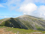
Pen yr Ole Wen is the seventh highest mountain in Snowdonia and in Wales. It is the most southerly of the Carneddau range. The mountain lies to the north of Idwal Cottage youth hostel on the A5 road, from where it has a pyramidal appearance. It may be climbed from the hostel by a path that leads directly up the south west "corner", climbing 675 m in about 1.5 km (i.e. an average gradient of nearly 1 in 2). A slightly easier ascent involves starting from Tal-y-Llyn Ogwen, about a mile north-east from the hostel, following the stream until nearing the outflow from the mountain lake Ffynnon Lloer and then branching left to take the path up the ridge. For many years the mountain's name was translated as "Head of the White Light", the interpretation of which was a mystery. However in 2004 Professor Hywel Wyn Owen at the Place-Name Research Centre at Bangor University in Bangor, Gwynedd resolved the matter saying that Ole comes from Goleddf, which means slope or hillside, making the correct English translation: "Head of the White Slope". Pen yr Ole Wen is often climbed as part of a longer route on the Carneddau range. It is the same height as England's highest peak, Scafell Pike. The mountain's average temperature hovers around 5 degrees Celsius.

Excerpt from the Wikipedia article Pen yr Ole Wen (License: CC BY-SA 3.0, Authors, Images).

Geographical coordinates (GPS)

Latitude Longitude
N 53.13723 ° E -4.01205 °
placeShow on map

Address

A5
LL57 3LZ , Llanllechid
Wales, United Kingdom
mapOpen on Google Maps

Pen yr ole wen
Pen yr ole wen
Share experience

Nearby Places

Carnedd Dafydd
Carnedd Dafydd

Carnedd Dafydd is a mountain peak in the Carneddau range in Snowdonia, Wales, and is the third highest peak in Wales, or the fourth if Crib y Ddysgl on the Snowdon ridge is counted. Situated south-west of Carnedd Llewelyn and north of Pen yr Ole Wen, Carnedd Dafydd is on the main ridge of the Carneddau, and on the border between Gwynedd and Conwy. The average annual temperature of the mountain is around 3–4 °C (38-40 °F). Carnedd Dafydd rises to height of 1,044 m (according to OS maps detail) and is usually climbed by first ascending Pen yr Ole Wen and then following the ridge along to Carnedd Dafydd, though it is also possible to make a direct ascent from Tal y Llyn Ogwen, first following the stream, Afon Lloer, to the mountain lake of Ffynnon Lloer then climbing up the slope to the summit. Like most of the summits in the southern Carneddau, it has a flat, boulder-strewn summit plateau. Immediately to the north lie the crags of Ysgolion Duon, well known to climbers. The origin of its name, which translates as Dafydd's (or David's) cairn, like that of its neighbouring peak, Carnedd Llewelyn (Llywelyn's cairn), are named after Llywelyn ap Gruffudd, the last independent prince of Wales, and his younger brother, Dafydd ap Gruffudd. The nearby peak Carnedd Lladron, commonly known as Carnedd Uchaf, has now been renamed by O.S. Carnedd Gwenllian in memory of Llywelyn's daughter Lady Gwenllian. Dafydd was captured at Nanhysglain, near Bera Mawr, on 21 June 1283; taken to Shrewsbury, he was hanged, drawn and quartered.

Welsh 1000 m Peaks Race

The Welsh 1000m Peaks Race takes place on the first Saturday in June each year. The 32 km route is also known as the Snowdonia Summits Marathon as competitors have to reach the top of all the 1000 metre peaks in Wales. Carnedd Llewelyn 1064m (3491 feet) Carnedd Dafydd 1044m (3425 feet) Glyder Fawr 1001m (3281 feet) Garnedd Ugain 1065m (3493 feet) and Snowdon (Yr Wyddfa) 1085m (3560 feet)Runners also have to pass through several other checkpoints; this gives a total of around 8000 feet of ascent for competitors. In previous years only the lower slopes of the Glyderau would be crossed, however in September 2010, the summit of Glyder Fawr was remeasured at 1001m.The organisers of the race included this summit from 2011. It is a tough endurance event and required navigational skills. The idea was the brainchild of Ron James, the warden of Ogwen Cottage Outdoor Pursuits Centre, along with Dr Ieuan Jones, who invited 60 people to participate in a trial event in 1970. The first race proper was held in 1971 with men starting from the shoreline at Abergwyngregyn, on the shoreline of Conwy Bay, and ladies from the Ogwen Valley. Both finished on the summit of Snowdon after which entrants were still responsible for their own safety and descent to the valley. The early events were for mountaineers, with kit checks to ensure boots were adequate & rucksacks a certain minimum weight, and groups such as West Bromwich Mountaineering Club participated every year. The Army supported the whole event, providing checkpoints throughout the route. Later a Fell running class was introduced and a team event. The Gorphwysfa Club took over the race organisation from the military in the 1990s. The fastest times are 3h 27m 20s recorded by Gavin Bland in 1999 and, for women, 4h 2m 39s by Angela Mudge also in 1999. The record for the team event (the accumulated times of the 3 best finishers) is 13h 41m 56s set in 1996 by the Reserves team of the Royal Regiment of Wales. The event is currently sponsored by the First Hydro Company.

Llyn Ogwen
Llyn Ogwen

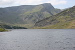
Llyn Ogwen (; Welsh: [ˈɬɪn ˈɔɡʊɛn]) is a ribbon lake in north-west Wales. It lies alongside the A5 road between two mountain ranges of Snowdonia, the Carneddau and the Glyderau. Somewhat unusually, the county boundary at this point is drawn so that the lake itself lies in the county of Gwynedd, but all the surrounding land (excluding the outflow) lies in Conwy County Borough. Llyn Ogwen lies at a height of about 310 metres above sea level and has an area of 78 acres (320,000 m2), but is a very shallow lake, with a maximum depth of only a little over 3 metres. It is fed by a number of streams from the slopes of the mountains which surround it, which include Tryfan and Pen yr Ole Wen. The largest of these streams is Afon Lloer, which flows from Ffynnon Lloer. It is said that after the Battle of Camlann (King Arthur's final battle), Sir Bedivere (Bedwyr) cast the sword Excalibur into Llyn Ogwen, where it was caught by the Lady of the Lake. Tryfan is said to be Sir Bedivere's final resting-place. According to the writer Jonah Jones:"J. M. Archer Thomson, a headmaster of Llandudno School and a pioneer rock climber in Snowdonia quotes a strange legend from a Welsh magazine concerning Llyn Ogwen. A Shepherd happened upon a cave in Craig Cwrwgl above the lake containing the treasure of King Arthur. In the midst of the commotion caused by this intrusion, he turned to the lake, and 'behold thereon a coracle in which sat three women of more than mortal beauty, but the dread aspect of the rower would have filled the stoutest heart with terror.' E. W. Steeple, who recorded this legend, suggests it 'seems a little obscure, and it may be that it has become involved with another story', probably that of Llyn Llydaw." Llyn Ogwen is the source of the Afon Ogwen which flows north to reach the sea near Bangor. A dam was built in the Afon Ogwen at Ogwen Bank, in the early 20th century, to raise the level of the river in order to provide water for the use in the nearby Penrhyn Quarry. The lake is popular with anglers and is said to contain excellent trout.