Worsley railway station
Beeching closures in EnglandDisused railway stations in SalfordFormer London and North Western Railway stationsPages with no open date in Infobox stationRailway stations in Great Britain closed in 1969 ... and 2 more
Railway stations in Great Britain opened in 1864Use British English from December 2016

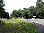
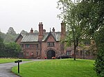
Worsley railway station was opened in 1864 to serve the town of Worsley in Greater Manchester. The Tyldesley Loopline closed in 1969 as a result of the Beeching Axe.
Excerpt from the Wikipedia article Worsley railway station (License: CC BY-SA 3.0, Authors, Images).Worsley railway station
Roe Green Loopline, Salford Moorside
Geographical coordinates (GPS) Address Nearby Places Show on map
Geographical coordinates (GPS)
| Latitude | Longitude |
|---|---|
| N 53.5006 ° | E -2.3663 ° |
Address
Roe Green Loopline
M28 2GH Salford, Moorside
England, United Kingdom
Open on Google Maps


