Stoneleigh, Warwickshire

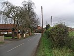
Stoneleigh is a small village in Warwickshire, England, on the River Sowe, situated 4.5 miles (7.25 km) south of Coventry and 5.5 miles (9 km) north of Leamington Spa. The population taken at the 2011 census was 3,636. The village is about 600 yards (549 m) northeast of the confluence of the River Sowe and the River Avon. The village's church is dedicated to the Virgin Mary. Stoneleigh has no public house: all three were closed by Lord Leigh more than 100 years ago, after his daughter was laughed at by drunks when she was going to church on a tricycle. However it has a social club, which meets in the evenings on Vicarage Road. Stoneleigh was the site of the most destructive tornado of the record-breaking nationwide tornado outbreak of 23 November 1981. The second-strongest tornado of the outbreak, rated as an F2/T4 tornado, passed through Stoneleigh and the surrounding areas at around 14:00 local time, causing severe damage including the complete destruction of a static caravan park and damage to residential buildings.
Excerpt from the Wikipedia article Stoneleigh, Warwickshire (License: CC BY-SA 3.0, Authors, Images).Stoneleigh, Warwickshire
Coventry Road,
Geographical coordinates (GPS) Address Nearby Places Show on map
Geographical coordinates (GPS)
| Latitude | Longitude |
|---|---|
| N 52.351436 ° | E -1.514719 ° |
Address
Coventry Road
Coventry Road
CV8 3BY
England, United Kingdom
Open on Google Maps


