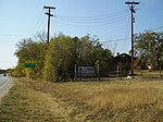
Onion Creek (Texas)
Geography of Austin, TexasGreater Austin geography stubsRivers of Blanco County, TexasRivers of TexasRivers of Travis County, Texas ... and 2 more
Texas river stubsTributaries of the Colorado River (Texas)

Onion Creek is a small tributary stream of the Colorado River in Texas. It begins 12 mi (19 km) southeast of Johnson City, Blanco County, Texas, and flows approximately 79 mi (127 km) eastward into the Colorado River, 2 mi (3.2 km) northwest of Garfield in Travis County, Texas. While areas surrounding the creek's origin in Blanco County are primarily rural, areas closer to its mouth in Travis County have more urban and industrial development. Passing near Dripping Springs, Driftwood, and Onion Creek, Onion Creek is the source of the waterfalls in McKinney Falls State Park. Onion Creek's watershed spans an area of 211 sq mi (550 km2).
Excerpt from the Wikipedia article Onion Creek (Texas) (License: CC BY-SA 3.0, Authors, Images).Onion Creek (Texas)
Prairie Dunes Drive, Austin
Geographical coordinates (GPS) Address Nearby Places Show on map
Geographical coordinates (GPS)
| Latitude | Longitude |
|---|---|
| N 30.1403 ° | E -97.7811 ° |
Address
Prairie Dunes Drive 4710
78747 Austin
Texas, United States
Open on Google Maps


