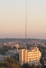
Sheikh Jarrah

Sheikh Jarrah (Arabic: الشيخ جراح, Hebrew: שייח' ג'ראח) is a predominantly Palestinian neighborhood in East Jerusalem, two kilometres (1+1⁄4 miles) north of the Old City, on the road to Mount Scopus. It received its name from the 13th-century tomb of Sheikh Jarrah, a physician of Saladin, located within its vicinity. The modern neighborhood was founded in 1865 and gradually became a residential center of Jerusalem's Muslim elite, particularly the al-Husayni family. After the 1948 Arab–Israeli War, it became under Jordanian-held East Jerusalem, bordering the no-man's land area with Israeli-held West Jerusalem until the neighborhood was occupied by Israel in the 1967 Six-Day War. Most of its present Palestinian population is said to come from refugees expelled from Jerusalem's Talbiya neighbourhood in 1948.Certain properties are subject of legal proceedings based on the application of two Israeli laws, the Absentee Property Law and the Legal and Administrative Matters Law of 1970. Israeli nationalists have been working to replace the Palestinian population in the area since 1967. Over a period of five decades, a number of Israeli settlements have been built in and adjacent to Sheikh Jarrah.
Excerpt from the Wikipedia article Sheikh Jarrah (License: CC BY-SA 3.0, Authors, Images).Sheikh Jarrah
Mujir A-Din, Jerusalem Sheikh Jarrah
Geographical coordinates (GPS) Address Nearby Places Show on map
Geographical coordinates (GPS)
| Latitude | Longitude |
|---|---|
| N 31.794444444444 ° | E 35.231944444444 ° |
Address
Mujir A-Din 8
9522901 Jerusalem, Sheikh Jarrah
Jerusalem District, Israel
Open on Google Maps


