place

Shanks House

Grade I listed buildings in South SomersetGrade I listed houses in SomersetHouses completed in the 17th century
Gates to Shanks House geograph.org.uk 496191

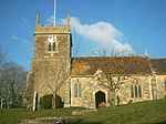
Shanks House in Cucklington, Somerset, England is a Grade I listed building.The first written records of the house date from the middle of the 16th century. In 1546 the house and 50 acres (20 ha) of land was sold to Robert Kemys, whose descendants sold it to the Watts family who held it until it passed into the Grant-Dalton family by marriage and through generations of descendants until the 20th century.During the 20th century it has been owned by the Sutton and Morley familiesThe two-story house with attics underwent major works in the 17th and 18th centuries, including refitting by Nathaniel Ireson.

Excerpt from the Wikipedia article Shanks House (License: CC BY-SA 3.0, Authors, Images).

Geographical coordinates (GPS)

Latitude Longitude
N 51.038611111111 ° E -2.3530555555556 °
placeShow on map

Address

Long Lane
BA9 9QL , Cucklington
England, United Kingdom
mapOpen on Google Maps

linkWikiData (Q7488761)
linkOpenStreetMap (533046928)

Gates to Shanks House geograph.org.uk 496191
Share experience

Nearby Places

Buckhorn Weston
Buckhorn Weston

Buckhorn Weston is a village and civil parish in the English county of Dorset, situated in the Blackmore Vale about 3 miles (5 kilometres) west of the town of Gillingham. It lies on the western edge of the former royal hunting ground of Gillingham Forest. The underlying geology is Oxford clay and Corallian limestone. In the 2011 census the civil parish had a population of 356.In Saxon times the area was known as Bokere Waston, which meant 'hamlet in the wilderness near the dyke'. Saxons invaded the area around 450 AD, driving out existing inhabitants and possibly erecting a heathen temple on the site of a previous place of worship. When the Saxons converted to Christianity in about 600 AD, they built a church to replace the temple.In 1086 Buckhorn Weston was recorded in the Domesday Book as Westone; it had 26 households, 6 ploughlands and 40 acres (16 hectares) of meadow. It was in Gillingham hundred and the tenant-in-chief was Count Robert of Mortain. In 1349 the village was badly affected by the plague and its population much reduced. Later, the estate passed via the Stourton family (associated with Stourhead) and the Fane family into the hands of the Stapleton family in 1837 who remained substantial local landowners until the death of Sir Miles Stapleton in 1979. The village inn still bears the family name and coat of arms. In celebration of the Millennium, the village was enabled to build a new village hall with the help of significant external funding. The Parish Church of St John the Baptist was well established by the beginning of the 13th century and has probably existed from earlier times. The present building dates largely from the 14th and 15th centuries, though in the 19th century much of it was significantly altered, which included the rebuilding of the west tower.

Bourton, Dorset
Bourton, Dorset

Bourton is a village and civil parish in north Dorset, England, situated north of the A303 road on the border with Somerset and Wiltshire between Mere and Wincanton. The parish is the most northerly in Dorset and in the 2011 census had a population of 822. Bourton is the most populous village in the electoral ward called Bourton and District. The District extends to Silton then south to Buckhorn Weston and Kington Magna. The total ward population at the abovementioned census was 1,905. The village lies on the River Stour which passes through the historic Bourton Mill, once home to the second largest water wheel in Britain (60 feet (18 m) in diameter) . The village has two stores, a petrol station and a public house. The White Lion Inn stands on the High Street, which leads off what was the old main London to Exeter road before the village was bypassed to the south in 1992 by the A303. St George’s Church, which stands on one of the highest points in the village, was built via public subscription in 1810 and borders the primary school of the same name. The point at which the counties of Dorset, Somerset and Wiltshire meet beside the lake at the rear of Bourton Mill is marked by Egbert's Stone which once fell into the River Stour, but was rescued and re-erected. In 878 it formed the rallying point for Alfred the Great's troops before the Battle of Ethandun. His grandfather, Egbert of Wessex, was said to have placed the stone there to settle the shire boundaries. Just over the county border is King Alfred's Tower. The mill, which is mentioned in the Domesday book, has had many incarnations. As a linen mill it processed flax and supplied canvas to the Royal Navy but when industry declined it was developed into a foundry with a blast furnace and was one of the first places to make the new threshing machines in the West of England. It went on to build boilers, steam lorries and gas engines as well as gaining a reputation as a builder of water wheels. During the First World War Mills Bombs were produced here in vast quantities. After the Gasper dam burst upriver in the summer of 1917, much of the machinery was washed from the factory and it took a number of years for industry to restart on the site. When it did return in 1933 the factory entered its final phase as a dried milk processing plant and this continued up until its closure in 1998. It has now been demolished to make way for the Mill Lake development. Chaffeymoor Lodge, located in an Area of Outstanding Natural Beauty at Chaffeymoor, is a large 17th-century house which retains original features including stone mullioned windows, large fireplaces and exposed beams. The extensive grounds include mature gardens, an ornamental pond, a croquet lawn and a lake, are recommended by The Royal Horticultural Society.The nearest railway station is in neighbouring Gillingham. Trains run on the Exeter to Waterloo line.