Hartburn, Northumberland
Use British English from August 2019Villages in Northumberland

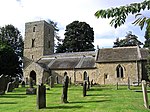
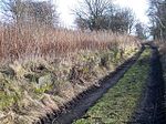
Hartburn is a village in Northumberland, in England. It is situated about 6 miles (10 km) to the west of Morpeth. The population at the 2011 census was 194.The place-name 'Hartburn' is first attested in Charter Rolls of 1198, where it appears as Herteburne. The name means 'stag stream'.The village is on the Hart Burn river, which a couple of miles downstream joins the River Wansbeck, which flows through Morpeth and Ashington to the sea.
Excerpt from the Wikipedia article Hartburn, Northumberland (License: CC BY-SA 3.0, Authors, Images).Hartburn, Northumberland
B6343,
Geographical coordinates (GPS) Address Nearby Places Show on map
Geographical coordinates (GPS)
| Latitude | Longitude |
|---|---|
| N 55.168 ° | E -1.862 ° |
Address
B6343
NE61 4JB
England, United Kingdom
Open on Google Maps


